Name/Title
1892 George Dodge's Map partialEntry/Object ID
2016-126-01Description
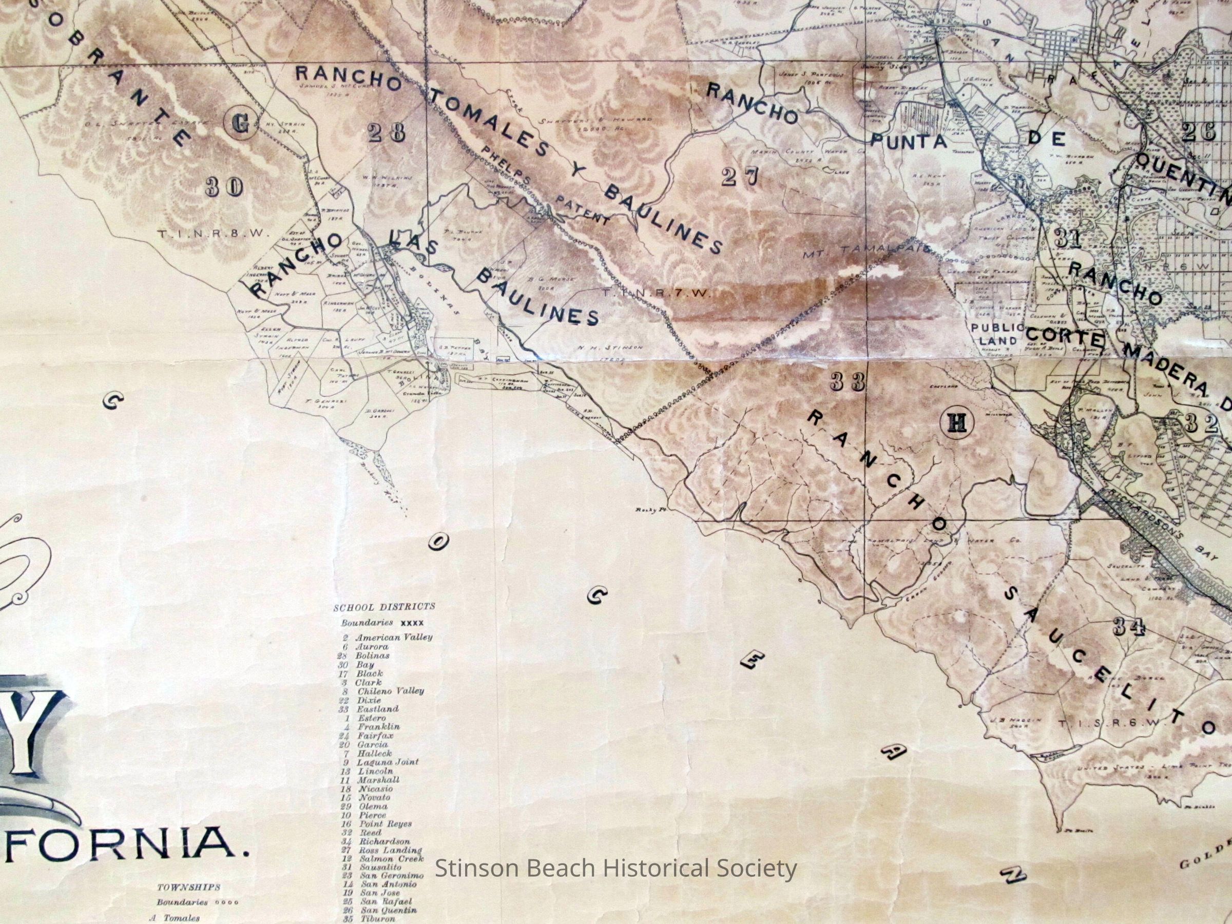
This is a portion of map titled "Official Map of California, 1892; compiled from Record and Survey by George M. Dodge C.E belonging to Bolinas Museum. This shows Rancho Baulines, portions of Rancho Tamales Y Baulines and Rancho Saucelito, Rancho Corte Madera. It includes besides the topographic land features, land owners names and their holdings by acreage.Collection
SBHS Photo Collection/Digital ImagesAcquisition
Accession
2016-126Source or Donor
Bolinas MuseumAcquisition Method
Collected by Staff