Name/Title
Seadrift 8/2/1960Entry/Object ID
2018-109-09Description
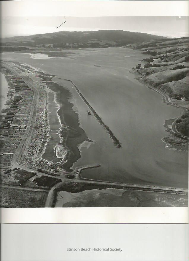
This aerial photo was taken from the south end of the Seadrift development on 8/2/1960. It shows the very beginning of the creation of the Dipsea Road side of Seadrift including the inner lagoon. This part of the inner Lagoon is dredged and the dredged material is piled on the east side of it. The dirt bar is seen to outline the Dipsea Road of the development. The dredge, the Curlew Side-Draft Dredge of the Associate Dredging Co, is seen working on this bar. There are 20 or so houses on the ocean side of the Seadrift Road which continues to the causeway to Highway One. There is a gate perpendicular to the causeway which is different from the present location of the gate. Calle del Arroyo, with Walla Vista Way jutting off to the left, is visible on the lower left of the photo, hills along the lagoon and the Bolinas Ridge completes the photo. On the back of the photo has stamp; AERO PHOTOGRAPHERS
COMMERCIAL AND AERIAL
INDUSTRIAL CENTER BUILDING, SAUSALITO, CALIF. 94965
332-1104
P.O.BOX 397
Order reprint from number A-5590
Date photographed 8-2-60
CREDIT LINE APPRECIATED
PHOTOGRAPHER: ED BRADYCollection
SBHS Photo Collection/Digital ImagesAcquisition
Accession
2018-109Source or Donor
Moushardt, Lucinda KentAcquisition Method
Gift