Name/Title
Seadrift 12/3/60Entry/Object ID
2018-109-11Description
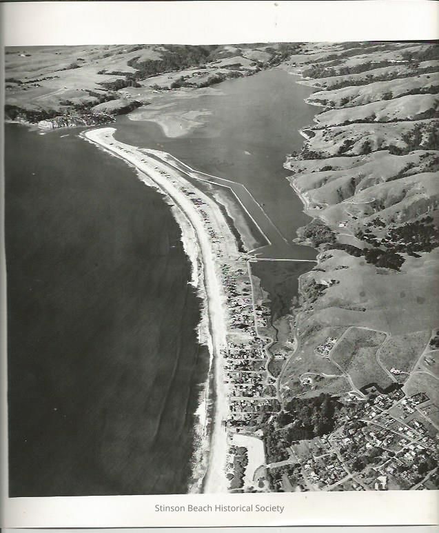
This aerial photo is taken from south toward Stinson Beach and points north, including the town of the Stinson Beach, Calles and Patios, Causeway, Seadrift, the Bolinas Bay and Lagoon, Bolinas Little Mesa and the part of Big Mesa. The bars outlining the inner lagoon, on the Dipsea Road side of development, is almost complete. The inner Seadrift Lagoon appears to need more dredging and the area that will become the Dipsea Road lots are still under water awaiting fill. The dredge in the Bolinas Lagoon is working on the bar that will outline the development. On the back of the photo has stamp:
AERO PHOTOGRAPHERS
COMMERCIAL AND AERIAL
INDUSTRIAL CENTER BUILDING, SAUSALITO, CALIF. 94965
332-1104
P.O.BOX 397
Order reprint from number A-5952
Date photographed 12-3-60
CREDIT LINE APPRECIATED
PHOTOGRAPHER: ED BRADYCollection
SBHS Photo Collection/Digital ImagesAcquisition
Accession
2018-109Source or Donor
Moushardt, Lucinda KentAcquisition Method
Gift