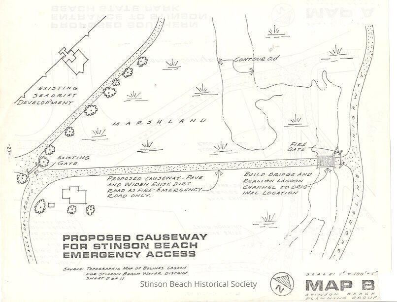
Name/Title
Map B Proposed Causeway for Stinson Beach Emergency AccessEntry/Object ID
2012A-101-02Description
Proposed Causeway for Stinson Beach Emergency Access named Map B was a page of book made for the public by the Stinson Beach Planning Group, predecessor of Stinson Beach Village Association. It proposes that the existing dirt service road to Seadrift from Shoreline Highway be paved, to realign the Lagoon Channel, and to build a bridge at the Shoreline Highway end.Collection
SBHS Archival Collection/Map CollectionAcquisition
Accession
2012A-101Source or Donor
Erma ParsonsAcquisition Method
Gift