HUB
Collections
Classifications
About
App
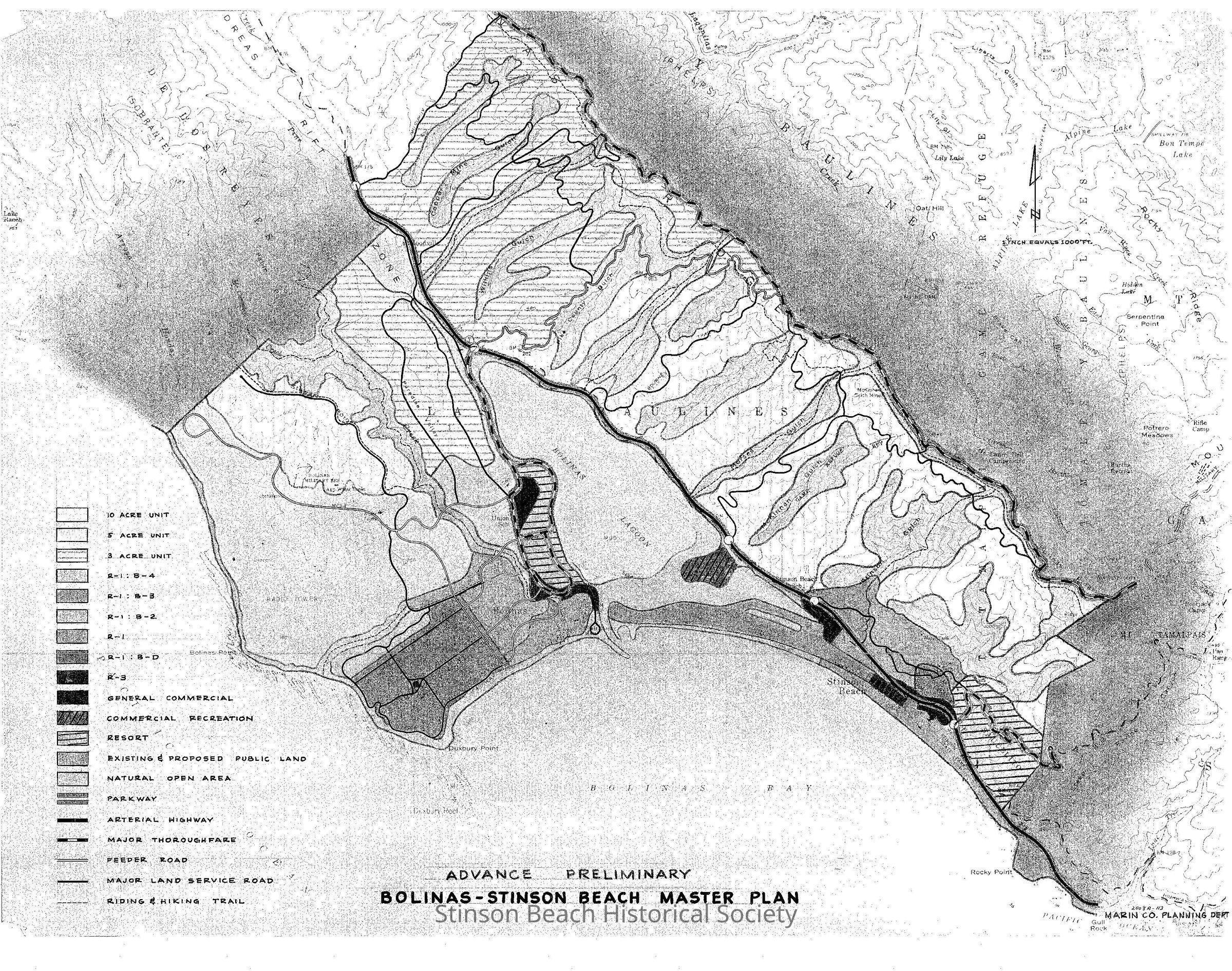
Bolinas/Stinson Master Plan Development, mid 60's
Map
-
Stinson Beach Historical Society
Bolinas-Stinson Master Plan De
Copyright: SBHS; Origsize: 34" x 45 1/2"; Origformat: Map; Resolution: 150
Name/Title
Bolinas/Stinson Master Plan Development, mid 60's
Entry/Object ID
2003A-113
Description
Color map of Stinson Beach and Bolinas, Bolinas Lagoon, Bolinas Bay, Stinson Gluch to Copper Mine Gluch,Bolinas Meas and Baulines Ridge showing permitted development.
Collection
SBHS Archival Collection/Map Collection
Acquisition
Accession
2003A-113
Source or Donor
Stinson Beach Village Association
Acquisition Method
Gift