Name/Title
Map of Farms along the LagoonEntry/Object ID
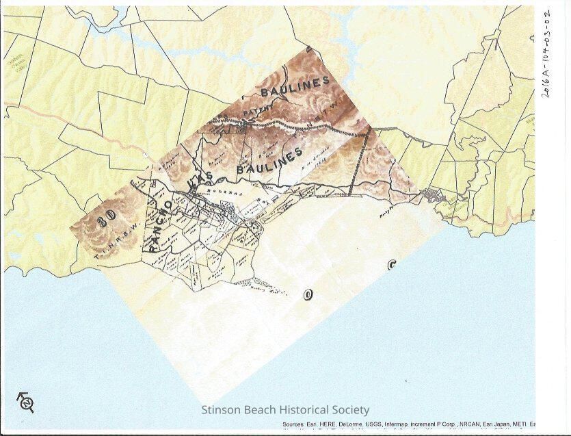
2016A-104-03-02Scope and Content
This is a map created by Richard Reasoner for his recollection described in 2016A-104-01. The map of 1892 George Dodge showing the area provided to him by SBHS through Bolinas Museum was inset larger map of Marin County.Collection
SBHS Archival Collection/DocumentsAcquisition
Accession
2016A-104Source or Donor
Tamae AgnoliAcquisition Method
Collected by Staff