Name/Title
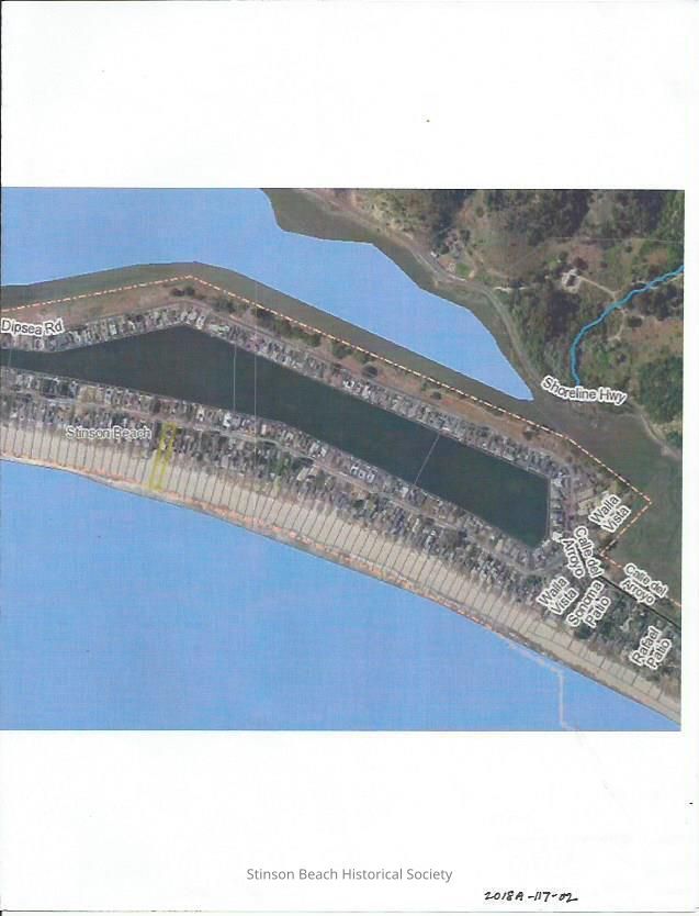
Seadrift Aerial Map in ColorEntry/Object ID
2018A-115-02Scope and Content
This is a colored aerial map of the Seadrift Development acquired from Marin County Planing Dept.
Insets: developmentCollection
SBHS Archival Collection/Map CollectionAcquisition
Accession
2018A-115Source or Donor
Marin County Planing DepartmentAcquisition Method
Field Collection