Name/Title
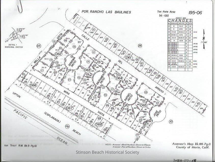
Seadrift Assessor's's MapEntry/Object ID
2018A-115-03Scope and Content
This is the assessor's parcel maps printed on 8.5 x11 papers including the Walla Vista portion of Seadrift where the gate starts. The total area is printed in 12 pages.Collection
SBHS Archival Collection/Map CollectionAcquisition
Accession
2018A-115Source or Donor
Marin County Planing DepartmentAcquisition Method
Field Collection