Map of Mt. Tamalpais

Map of Mt Tamalpais: Copyright: SBHS; Origsize: 8 x 10; Origformat: Photgraphic print; Resolution: 72, 360; Negno: 26 #10
Map of Mt Tamalpais

Copyright: SBHS; Origsize: 8 x 10; Origformat: Photgraphic print; Resolution: 72, 360; Negno: 26 #10

Name/Title

Map of Mt. Tamalpais

Entry/Object ID

1993-688-01

Description

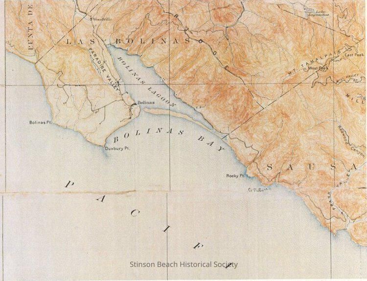
A color photographic print of a US Geological survey, California,Tamalpais Sheet, edition of 1897 (May), reprinted May 1907. Shows the portion encompassing the peak of Mt. Tam, Rocky Pt., Bolinas Bay, Bolinas town, Bolinas Point, The Pacific. It is taken from the copy in S.B. Library.

Collection

SBHS

Acquisition

Accession

1993-688

Source or Donor

Engel, Albert

Acquisition Method

Gift