Name/Title
Water - Bathymetric Surveys 2Entry/Object ID
2013A-110-15Scope and Content
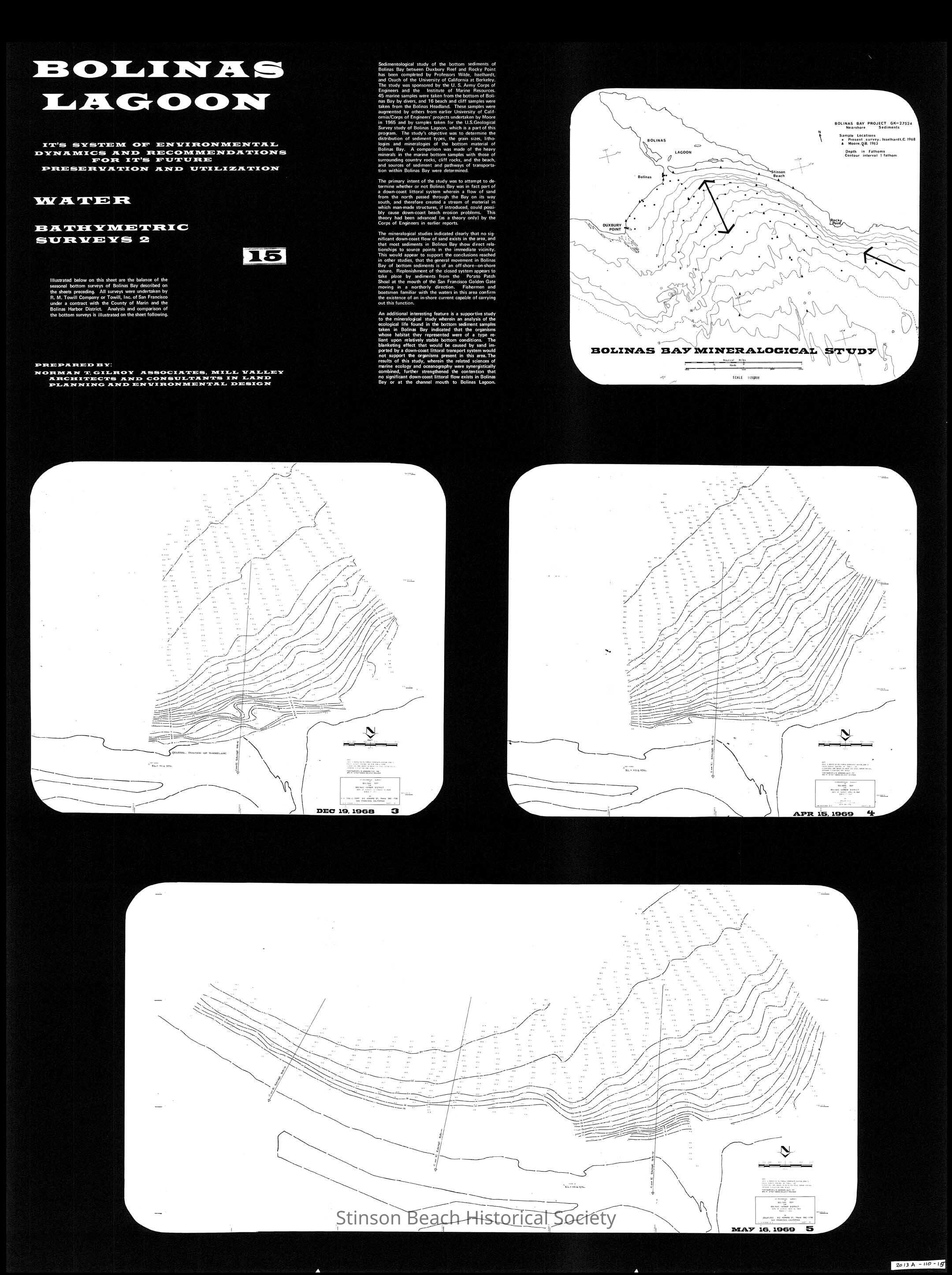
Continuation of bathymetric (bottom sediment) studies of Bolinas Lagoon to define movement on a seasonal basis. These maps chronicle mineralogical studies between Duxbury Reef and Rocky Point conducted in 1968 and 1969 and showing no significant down-coast flow of sand but rather off-shore on-shore movement.
Page 15 of the graphic presentation of "Bolinas lagoon" It's System of Environmental Dynamics and Recommendations for It's Future Preservation and Utilization.
"Bolinas lagoon" Its System of Environmental Dynamics and Recommendations for It's Future Preservation and Utilization was the study made by Norman T. Gilroy Associates preparation for the Bolinas Harbor District.
Insets: 4 graphic mapsCollection
SBHS Archival Collection/Map Collection