Name/Title
MapEntry/Object ID
2026.1.14Description
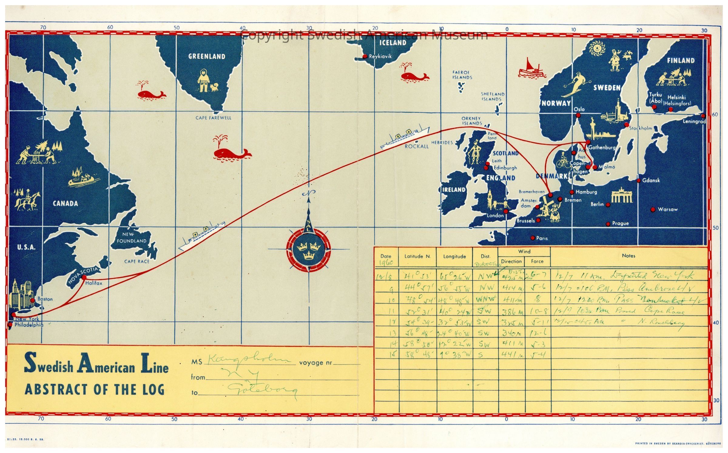
Map of journey of the M.S. Kungsholm from New York to Gothenburg with hand inscribed latitude and longitude tracking on the trip from Dec. 8-15, 1960.Context
The Swedish American Line (SAL) opened in 1915 and was used for immigrant travel until the mid-1920s. The SAL had four ships, SS Stockholm, TS Drottningholm, MS Gripsholm, and SS/MS Kungsholm. Ships ran direct from Gothenburg to New York. By the end of the 1920s, the SAL became a luxury cruise and tourist line, which many people used to travel between Sweden and the U.S.Acquisition
Accession
2026.1.14Source or Donor
Found in CollectionAcquisition Method
Found in collectionLexicon
LOC Thesaurus for Graphic Materials
Ocean travel, Travel, Boat & ship industry, MapsSearch Terms
Swedish American LineMap Details
Printer
Skandia-TryckerietPlace Printed
City
GöteborgCounty
Västra GötalandCountry
SwedenRegion
Northern EuropeContinent
EuropeMedium
PaperDimensions
Width
10 inLength
17-1/2 inRelationships
Related Person or Organization
Person or Organization
Swedish American LineCopyright
Copyright Details
Ownership was legally transferred to the Swedish American Museum per the gift agreement. Certain works may be protected by copyright not governed by the Swedish American MuseumReproductions
Notes
Reproduction of the Museum's archives for publication, commercial use, or distribution requires written permission.