Name/Title
S02.07.054Description
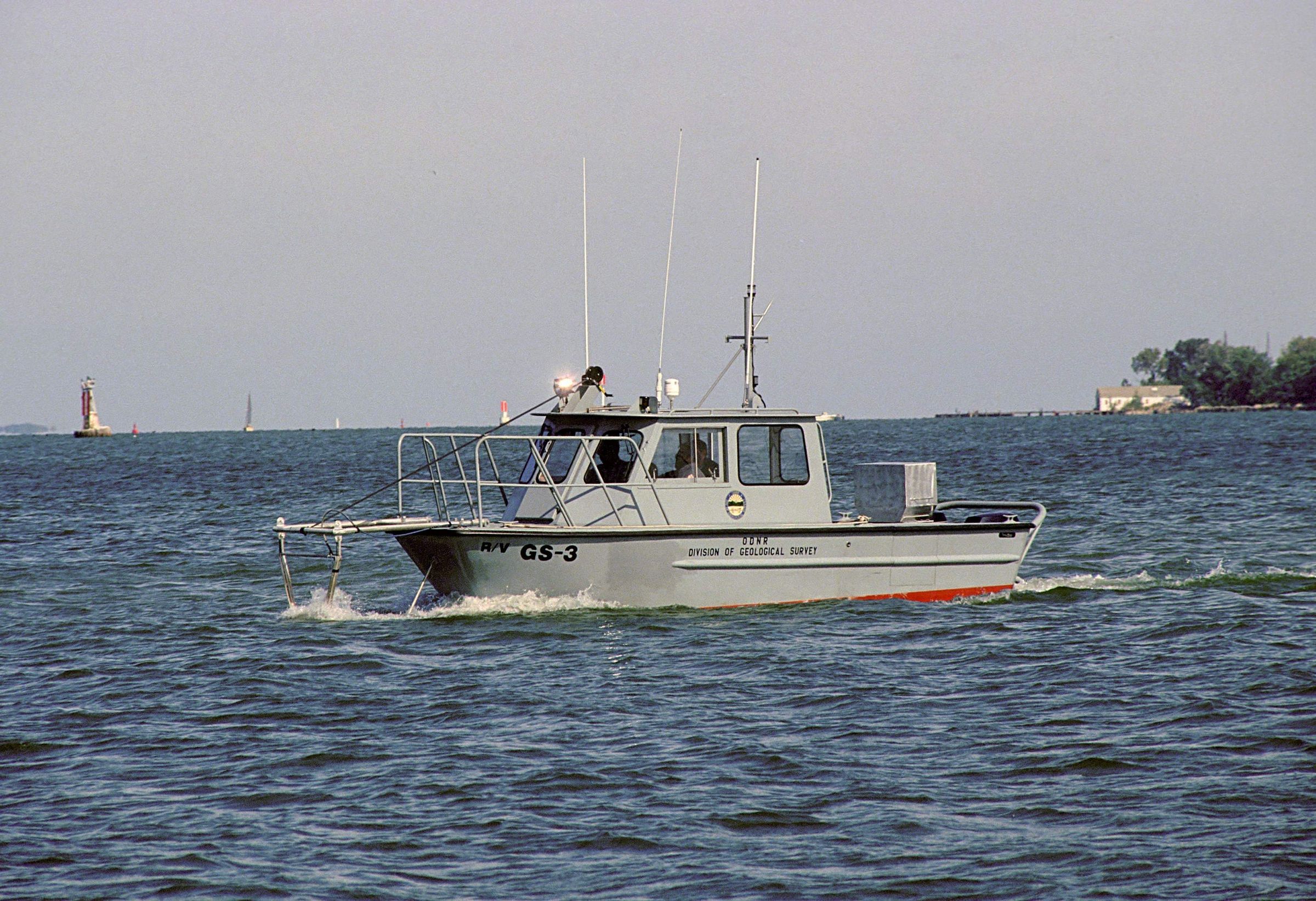
The Lake Erie Group Section's boat, R/V GS-3 (Research Vessel Geological Survey-3). The GS-3 was custom built to specifications by an out-of-state builder to accomodate the sidescan sonar equipment. The vessel is shown here in working mode with the bow-mounted sidescan down in the water off the front of the vessel, looking North. The GS-3 vessel was acquired circa 1993. The slide is dated 1997. The location given is in Sandusky Bay approximately half way down the straight channel leading from Mosely channel to the Sandusky dock channel in Erie County Ohio.
In 1961, the Division of Shore Erosion, one of the seven original divisions in the Ohio Department of Natural Resources, was abolished and its functions distributed to the Division of Geological Survey, the Division of Watercraft, and the newly created Office of the Engineer. The geologic research and mineral-extraction permitting of the Division of Shore Erosion became the Lake Erie Section of the Division of Geological Survey at that time. During its 46 year association with the Division of Geological Survey, the Lake Erie Section researched sediment distribution and stratigraphy, water quality and currents, shore erosion and erosion forecasts, riverine and near-shore habitat studies, and management of littoral sand resources. The office of the Lake Erie Section was located at 305 East Shoreline Drive, Sandusky, Ohio 44870. The Sandusky office of the Lake Erie Geology Group Section was closed in January 2008 as a result of budget constraints.
In an e-mail from Dale L. Liebenthal to Lisa Long on July 21, 2016: We named our boats GS for Geological Survey and the first named vessel was the GS-1. The name used to be SE-1 for Shore Erosion, because we were a whole division here called the Division of Shore Erosion. The name was later changed when we became a sub-section of the Geological Survey. We normally didn’t name smaller vessels but we found that it was easier to plan field work by naming specific equipment to students and college interns who were not familiar with them. So we had the GS-1, the large research vessel used outside of sheltered bays,; the GS-2 was a small 14 foot long boat which was used in the near shore with detailed depth sounding equipment to acquire depths along the shoreline out to 1500 to 2000 feet offshore to determine erosion and accretion at specific points along the Ohio shore.; The GS-3 was a vessel whose construction I was heavily involved in to provide a platform to employ side scan sonar in near shore environments. The vessel was custom built from our specifications by an out-of-state builder. The picture you attached [i.e. S02.07.054.tif] shows the vessel in working mode with the bow-mounted side scan down in the water off the bow or front of the vessel, looking North. We acquired the vessel in 1993, or thereabouts. We had a couple of other small vessels but they were not named because they were seldom used. Each vessel had a specific purpose but could be used for multi-task work.
Information about the history of the Ohio Geological Survey’s Lake Erie Group Section is available in Lake Erie Geology Office Closes by Don Guy, Dale Liebenthal, and Michael C. Hansen (Ohio Geological Survey, Ohio Geology Newsletter, No. 1, 2008) pages 6 and 7.
This slide image included in the USGS National Digital Catalog for NGGDPP Grant G15AP00115 in FY2015.Context
Pontoon boat sailing through the lake water. Sandusky Bay in Lake Erie, Ohio.