Name/Title
S04.03.009Description
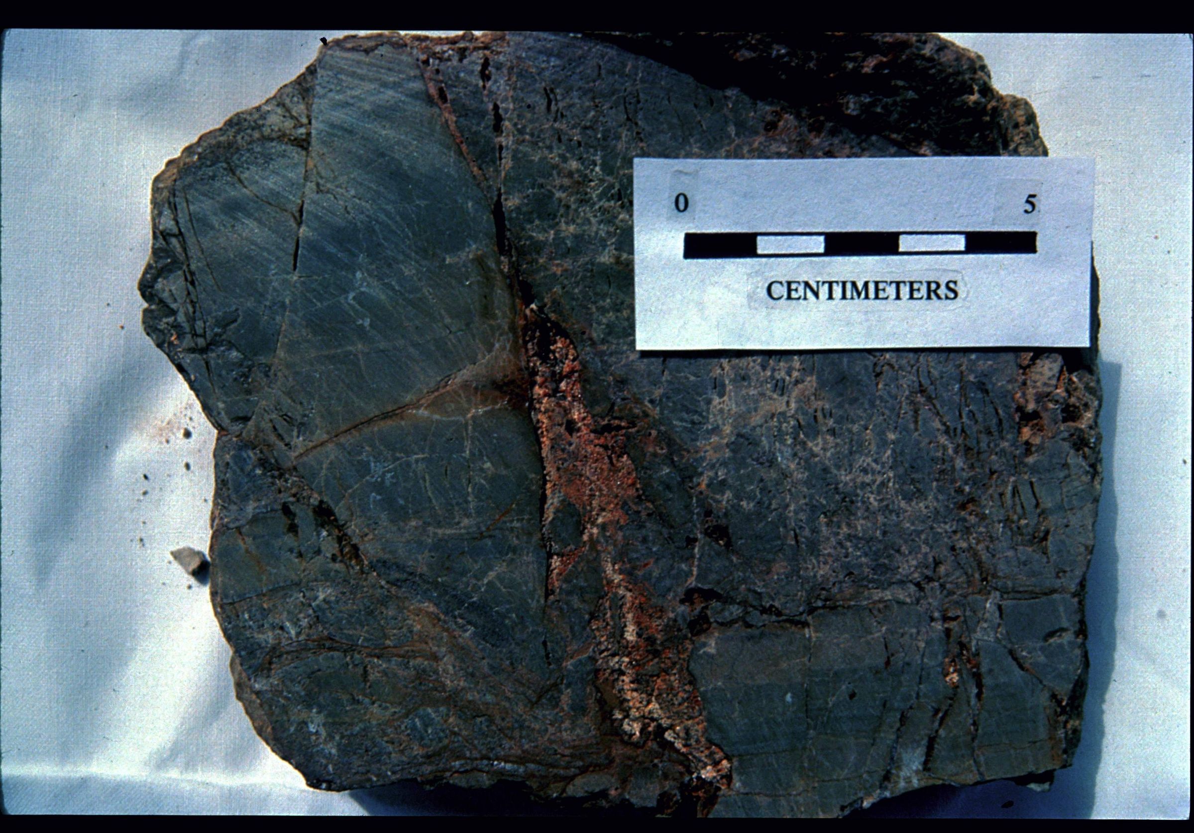
Sphalerite filling fractures and cementing breccia fragments in Greenfield-Tymochtee Dolomite from along a boundary fault on the southeastern side of the impact structure near Ohio State Route 41 (from pages 395 and 402 for the description of Stop 6 in The Serpent Mound Cryptoexplosion Structure, Southwestern, Ohio by Stephen P. Reidel and Frank L. Koucky part of the Geological Society of America's GSA Cincinnati '81 Field Trip Guidebooks, v. 2. Economic Geology, Structure).
The Serpent Mound Impact Structure is an approximately 9-mile-diameter area of highly disturbed and structurally deformed bedrock at the intersection of Adams, Highland and Pike counties. The area of the impact structure has dolomite, shale, limestone, sandstone, and siltstone lithologies. Because of the geologic forces that have acted on the site of the impact crater, bedrock in the area is a mixture of uplifted, down dropped, faulted, folded and eroded rock from the Ordovician, Silurian, Devonian and Mississippian Geologic Periods. The deeply eroded crater is believed to have been formed by an asteroid or a comet impact approximately 250 to 300 million years ago. It is named the Serpent Mound Impact Structure after the prehistoric American Indian effigy earthwork located near the southwestern edge of the area. It is the single-most complex geologic structure exposed at the surface in Ohio. Investigation of the impact structure has been done using rock cores, seismic data, geophysical surveys and remote satellite imagery for the area.
This slide image included in the USGS National Digital Catalog for NGGDPP Grant G15AP00115 in FY2015.Context
Fractured dolomite sample laid out; small ruler resting at top of sample. From Serpent Mound Impact Structure in Adams County, Ohio.