Name/Title
S08.01.123Description
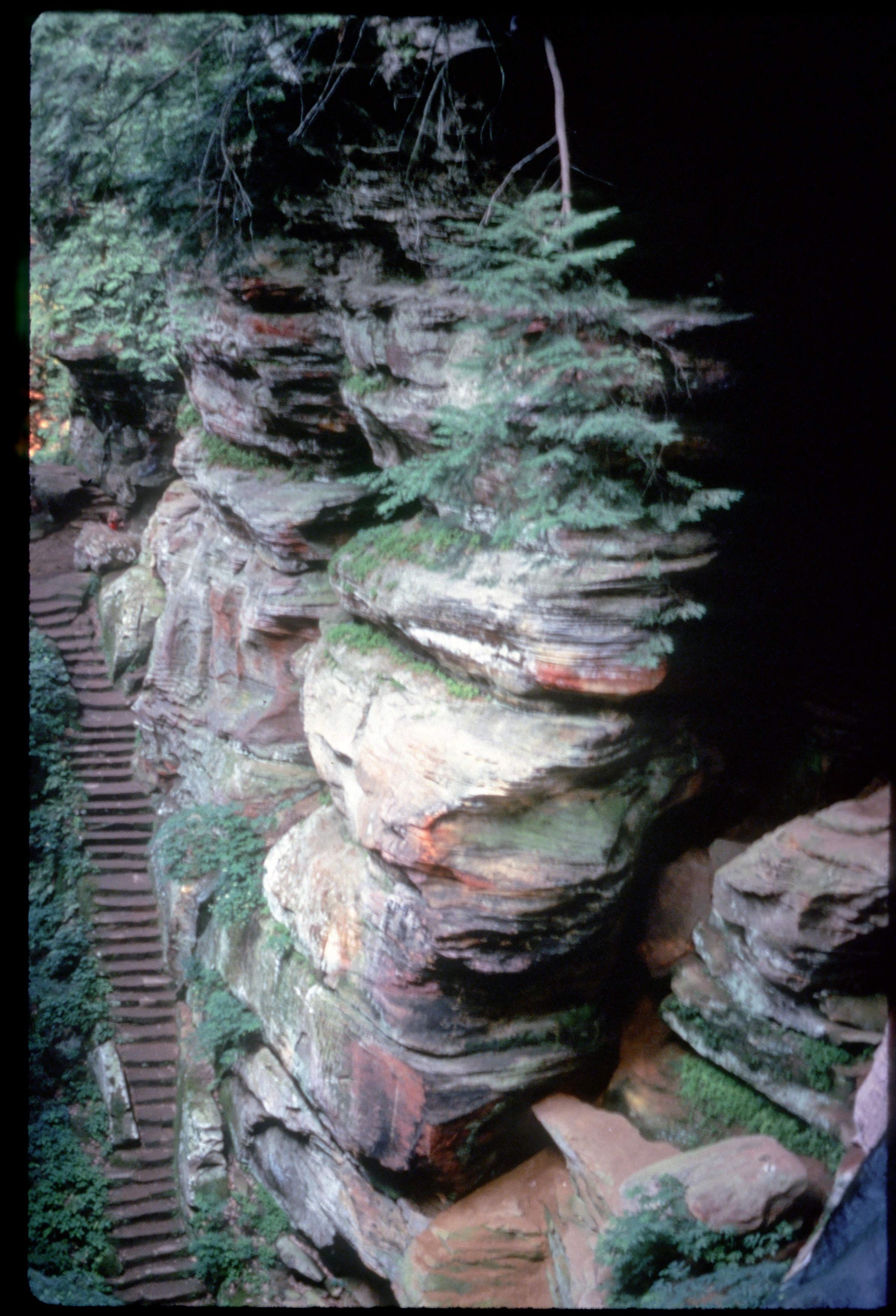
Black Hand Sandstone rises 150 feet from the valley floor overlooking Laurel Run. Halfway up the face of the cliff is a row of five to seven windows separated by five massive columns of stone. Inside is a tunnel-like passage about 200 feet long, 20 to 30 feet wide, and 20 to 25 feet high. This cavern resulted from a major joint fracture that runs parallel to the long corridor. Rock House is a product of differential weathering along these joints. The cavern is located in the middle zone of the Black Hand Sandstone. The more resistant upper zone forms the roof of the passage, and the lowermost zone forms the floor. Rock House has an array of colors including bright buff along fresh exposures. Shades of brown, red, and orange are due to staining by iron compounds on the weathered surfaces. Pale green appears where moss and lichens grow on the damp surface of the sandstone. Bedrock is from the Mississippian Geologic Period.
Information taken from The Geology of Hocking State Park by John F. Hall (Ohio Geological Survey, Information Circular No. 8, 1953) and Geology of the South Bloomingville Quadrangle, Hocking and Vinton Counties, By Richard M. DeLong (Ohio Geological Survey, Report of Investigations, No. 63, 1968) and Geology of the Hocking Hills State Park Region by Michael C. Hansen (Ohio Division of Geological Survey, Guidebook No. 4, 1975).
This slide image included in the USGS National Digital Catalog for NGGDPP Grant G15AP00115 in FY2015.Context
Small and round boulders with plants at the top. Overlooking Laurel Run at Hocking Hills State Park.