Name/Title
S11.14.034Description
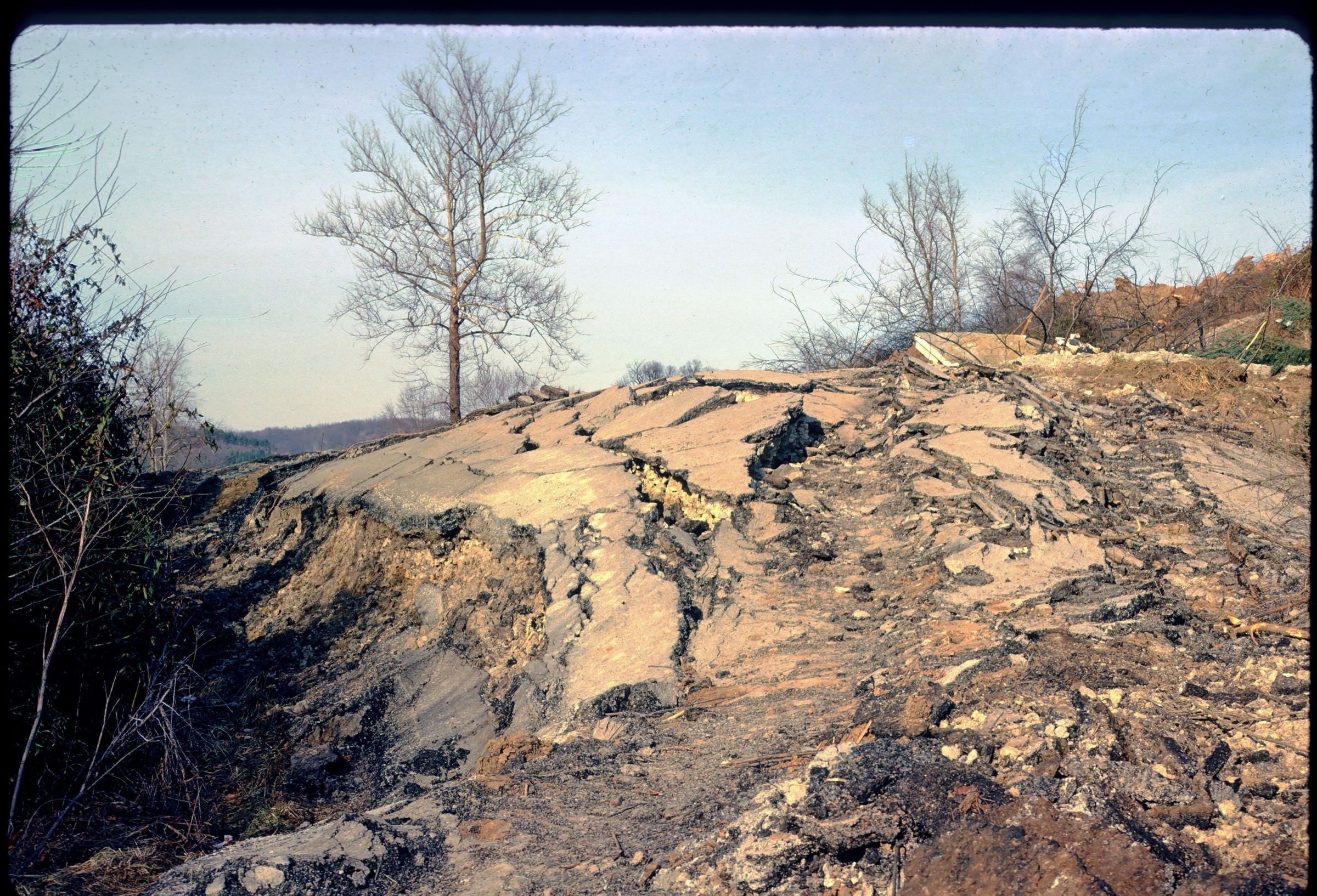
Damage to Hastings Road below the Monticello Village Apartments landslip in Athens, Athens County, Ohio. The Monticello Village Apartments was a complex of fourteen to sixteen buildings when construction was finished in 1968. The level area on which the apartment buildings were constructed was fashioned from a cut on the hillside in the Clarksburg red bed. The mudstone removed in this cut was used as fill on the edge of the hill in order to expand the level area for apartment construction. On November 4, 1972, the slope failed, causing the destruction of a 150 meter section of Hastings Road in the location of Ohio State Route 32. On November 7, 1972, four buildings were evacuated after additional rapid movement of the slope. By July 1974, a total of eight to nine buildings had been removed from the site due to continued threat of slope movement. Even those apartment buildings located farthest from the slide area, and seemingly out of danger from the slope failure, were affected by rockfall from boulders spalled from the massive Connellsville sandstone overlying the Clarsburg red bed of the Conemaugh Group. Unit lithology in this area is shale, siltstone, mudstone, sandstone, limestone and coal. Bedrock is from the Pennsylvanian Geologic Period. This slide of the Hastings Road damage in 1972 was made by Michael C. Hansen in 1974.
For more information, see: When the Hills Come Tumbling Down--Landslides in Ohio by Michael C. Hansen (Ohio Geological Survey, Ohio Geology Newsletter, Spring 1986) pages 1+.
See detailed background information in: Monitoring Slump-Earthflow Complex Movement: A Southeastern Ohio Case Study by Jon W. Van De Grift and Dorothy Sack, Department of Geography, Ohio University, Athens (Ohio Journal of Science, vol. 104, no. 5, December 2004) pages 126-135.
REVIEW
This slide image included in the USGS National Digital Catalog for NGGDPP Grant G15AP00115 in FY2015.Context
Road broken up into pieces. Hastings Road below Monticello Village Apartments in Athens, Ohio.