Name/Title
S26.04.103Description
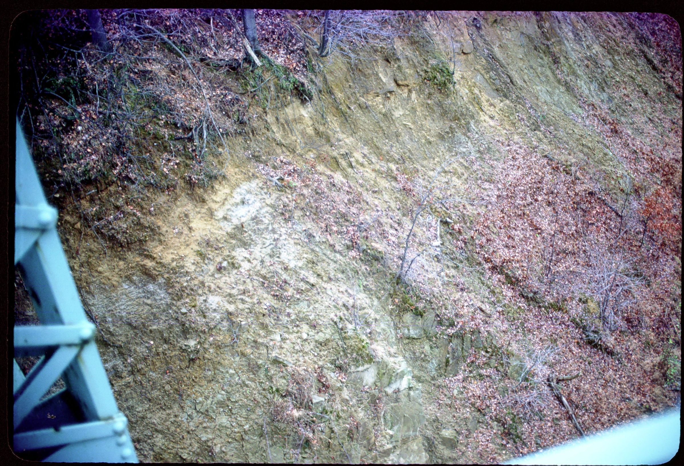
An outcrop of the Allegheny Group showing slump structure along the Baltimore and Ohio Railroad Company cut northwest of Mineral City, Tuscarawas County, Ohio. This area has shale, siltstone, sandstone, conglomerate, limestone, coal, clay and flint lithologies. Bedrock is from the Pennsylvanian Geologic Period. The photograph was taken by Michael C. Hansen in 1981. The truss bridge was removed, the railroad cut was filled and County Road 107 (Sandyville Road) was constructed on top of the fill on a different allignment in the 1991 construction season by the Tuscarawas County Engineer's Office.
The following information concerning the Baltimore and Ohio Railroad Company cut at Mineral City is taken verbatim from pages 143 through 145 for Stop Number 2 on Field Trip 4: Pennsylvanian Geology of Eastern Ohio in Guidebook for Field Trips, Cincinnati Meeting, 1961/ by Geological Society of America, New York : Geological Society of America (Guidebook Series), 1961. This cut exposes one of a number of known slump structures that are found in a linear belt that trends north by northeast of this locality. The slump blocks are not tectonic in origin, but rather true slump blocks that are believed to have moved as a unit from a valley wall into a deeply eroded valley. The slump-block scarp is spoon shaped and concave. The slump blocks have rotated backward so that the strata near the sole of the slump scarp dips back toward the fault scarp, while beds at the leading edge of the slump block dip away from the scarp. Faulting within the block is common.
….A coal bed with a thick underclay is found at three places in this cut. This coal is tentatively identified as the Middle Kittanning. Near the south end of the cut and on the east side of the track the coal dips northwest and strikes northeast; its relation to the sandstone in the deep part of the cut is obscured by a covered interval. North of the bridge and on the east side of the track the coal has a similar attitude. At the north end of the cut on the west side of the track the coal is horizontal but to the south dips below track level.
The Lower Freeport (?) coal and freshwater limestone is conspicuous on the west side of the track and south of the bridge. These members also have a northwest dip and northeast strike. The freshwater limestone is also present on the east side of the track at a point below the north edge of the bridge.
Two conspicuous sandstone bodies are present, one east of the track and south of the bridge; the other west of the track and north of the bridge. Both have a similar attitude, but the northern body is terminated sharply at its southern edge by a fault plane. The fault plane strikes north 35 degrees and dips 65 degrees southwest. Butting against this fault plane and folded into a tight syncline is a sequence of hard, carbonaceous, fossiliferous shale and a little higher a freshwater limestone. A few feet above the freshwater limestone is a capping sandstone of indeterminate age. This flat-lying sandstone is present on both sides of the cut.
This slide image included in the USGS National Digital Catalog for NGGDPP Grant G15AP00115 in FY2015.Context
Zoomed in view of limestone outcrop at Baltimore & Ohio Company railroad cut. Tuscarawas County, Ohio.