Type
InscriptionLocation
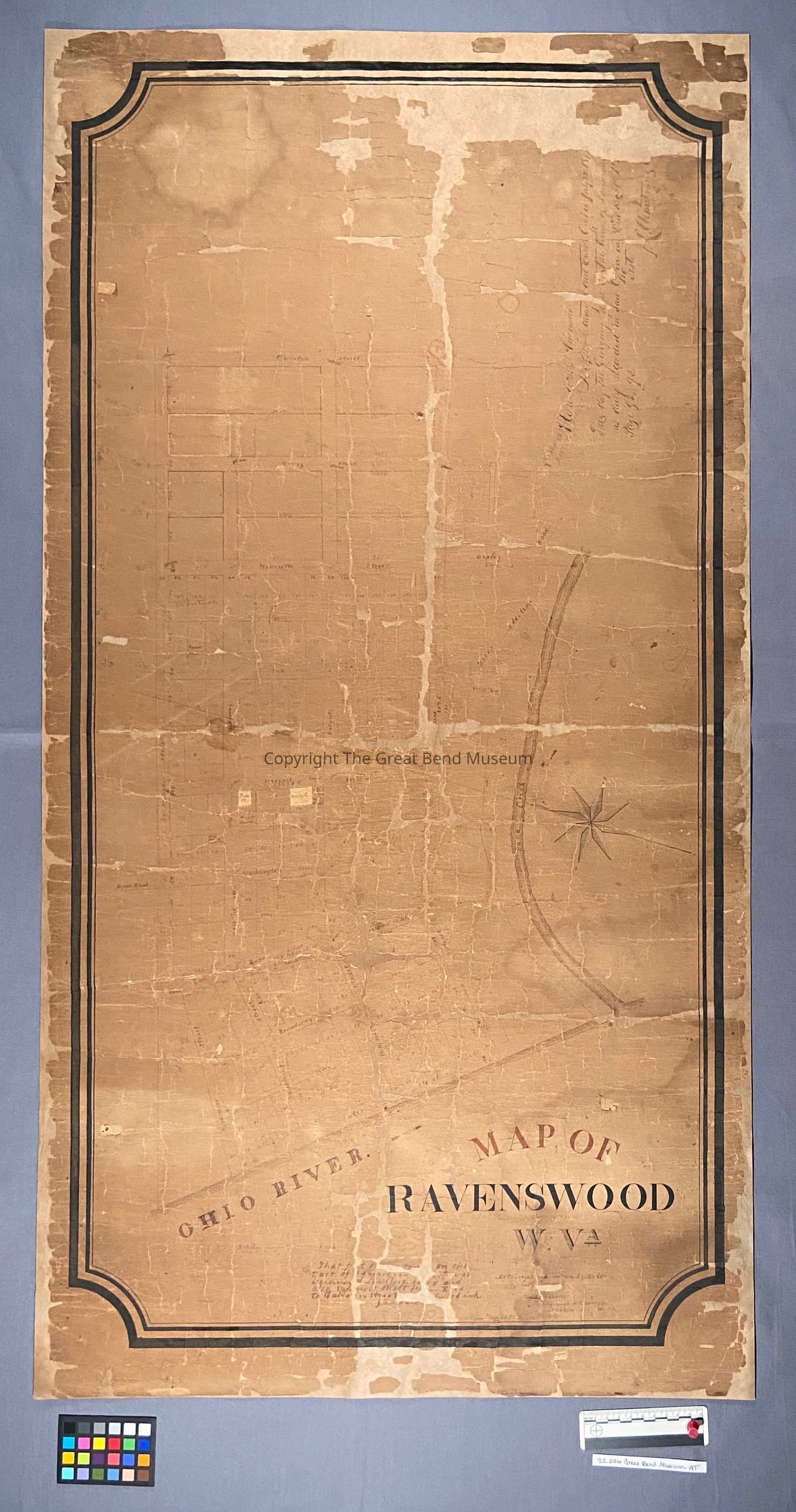
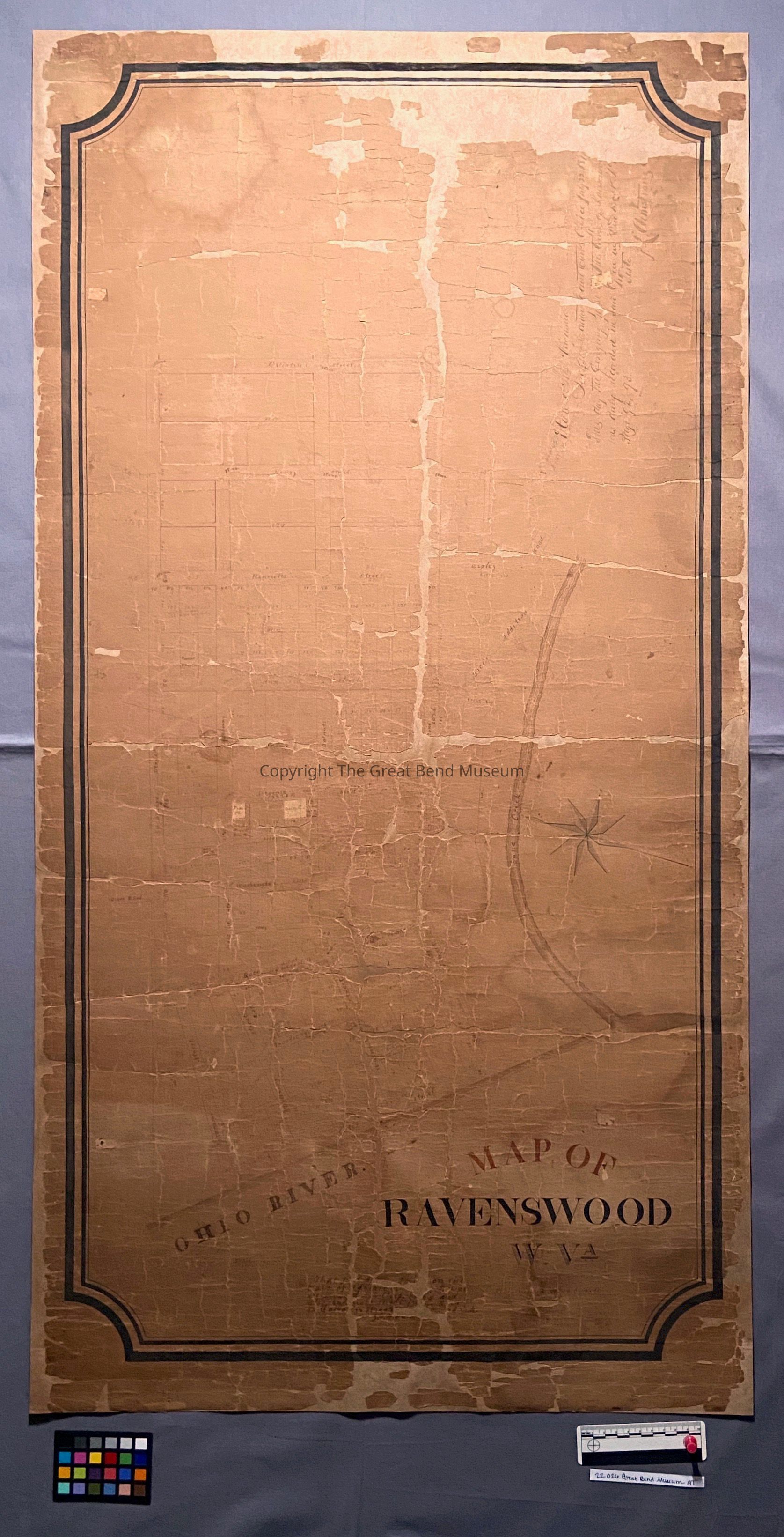
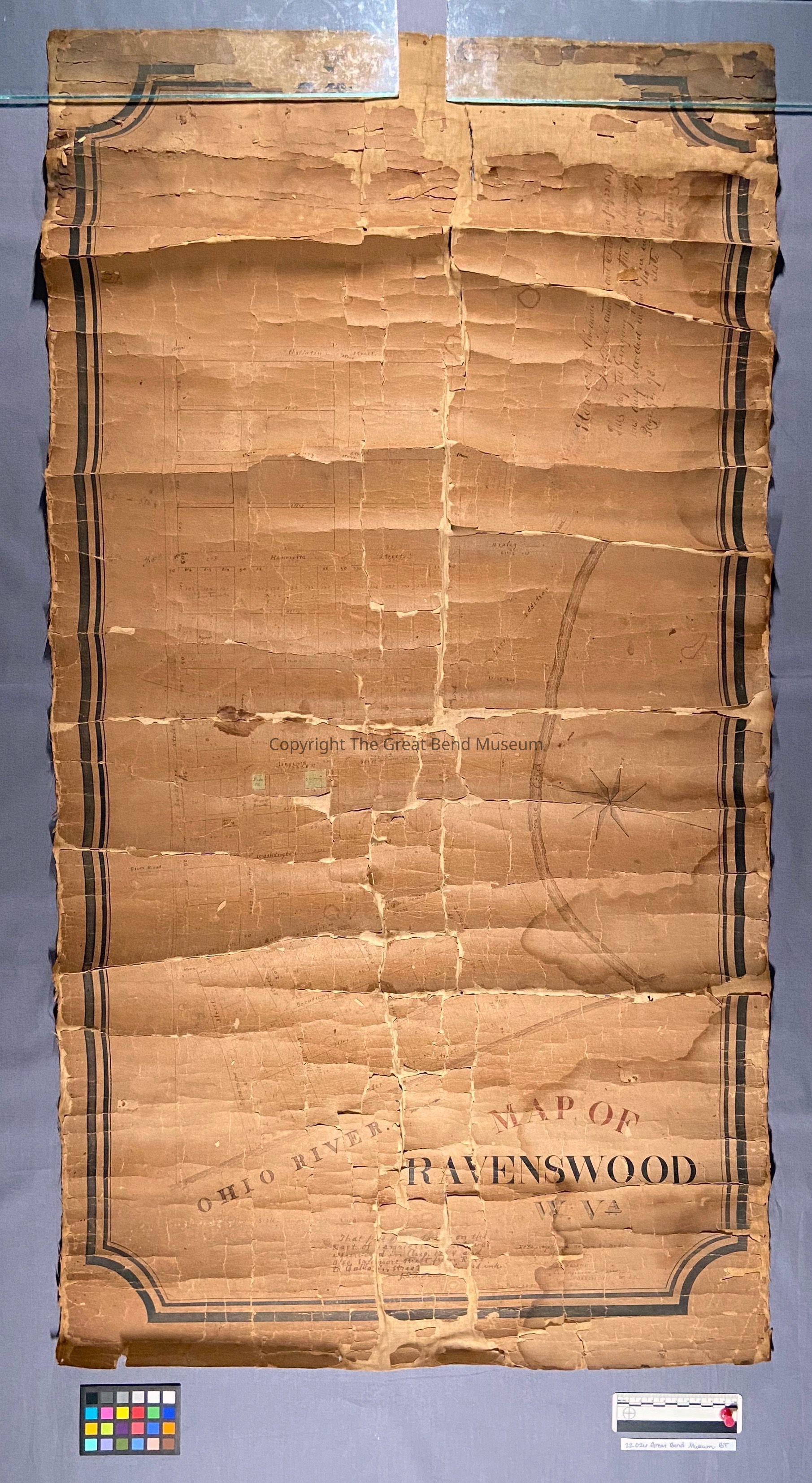
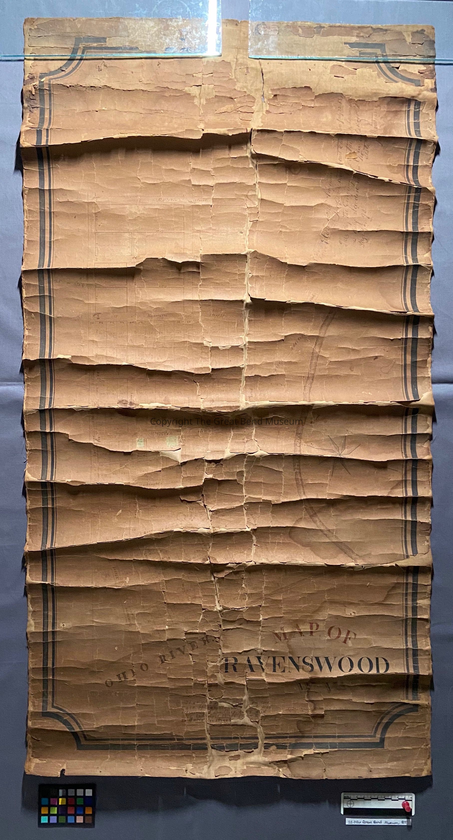
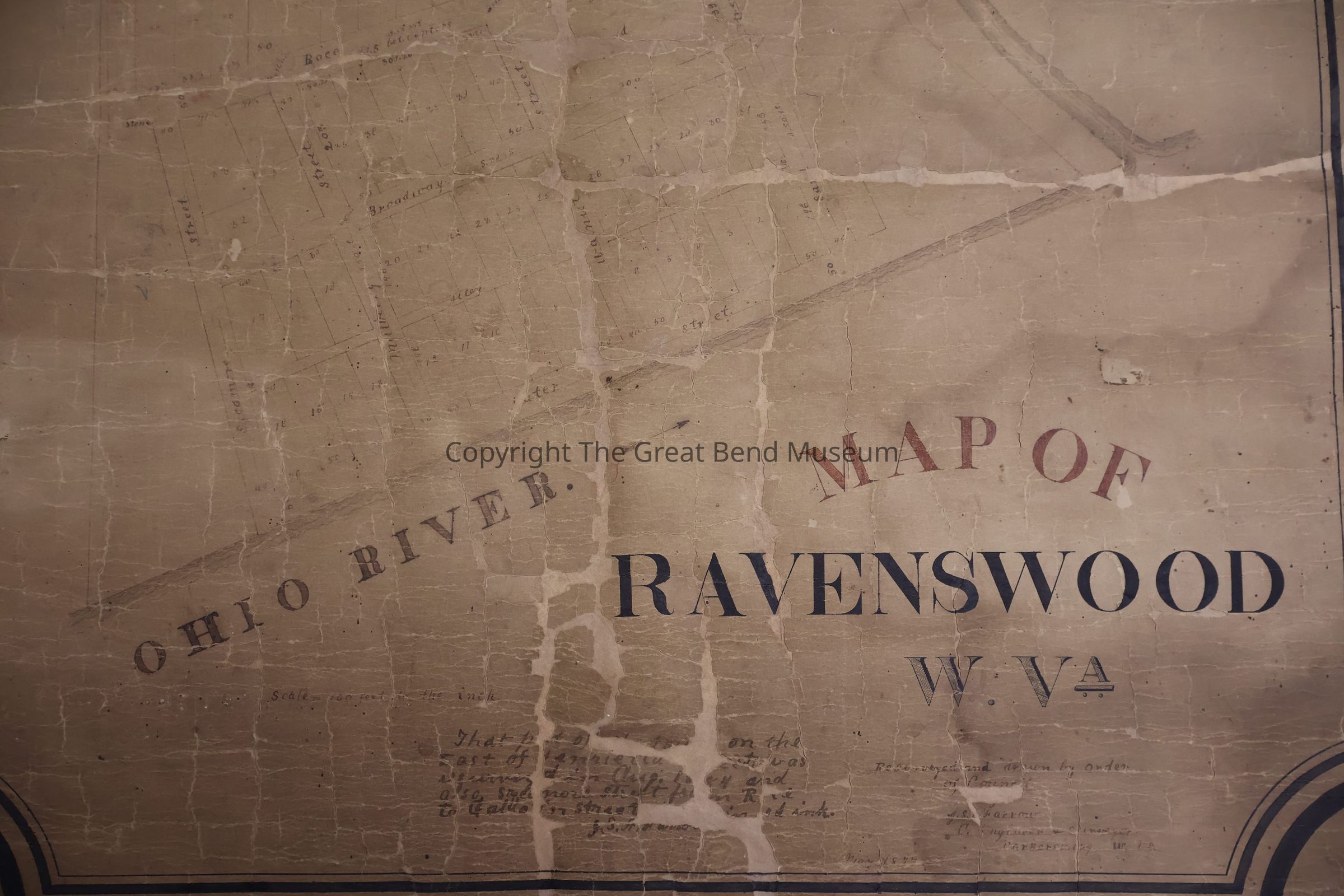
Recto, At bottom left centerTranscription
“MAP OF / RAVENSWOOD / W. V.A. / Resurveyed and drawn by order / of Council / J. S. [illegible] Farrow / C. Engineer & Surveyor / Parkersburg, W. V.A. / May 1877”.Material/Technique
InkType
InscriptionLocation
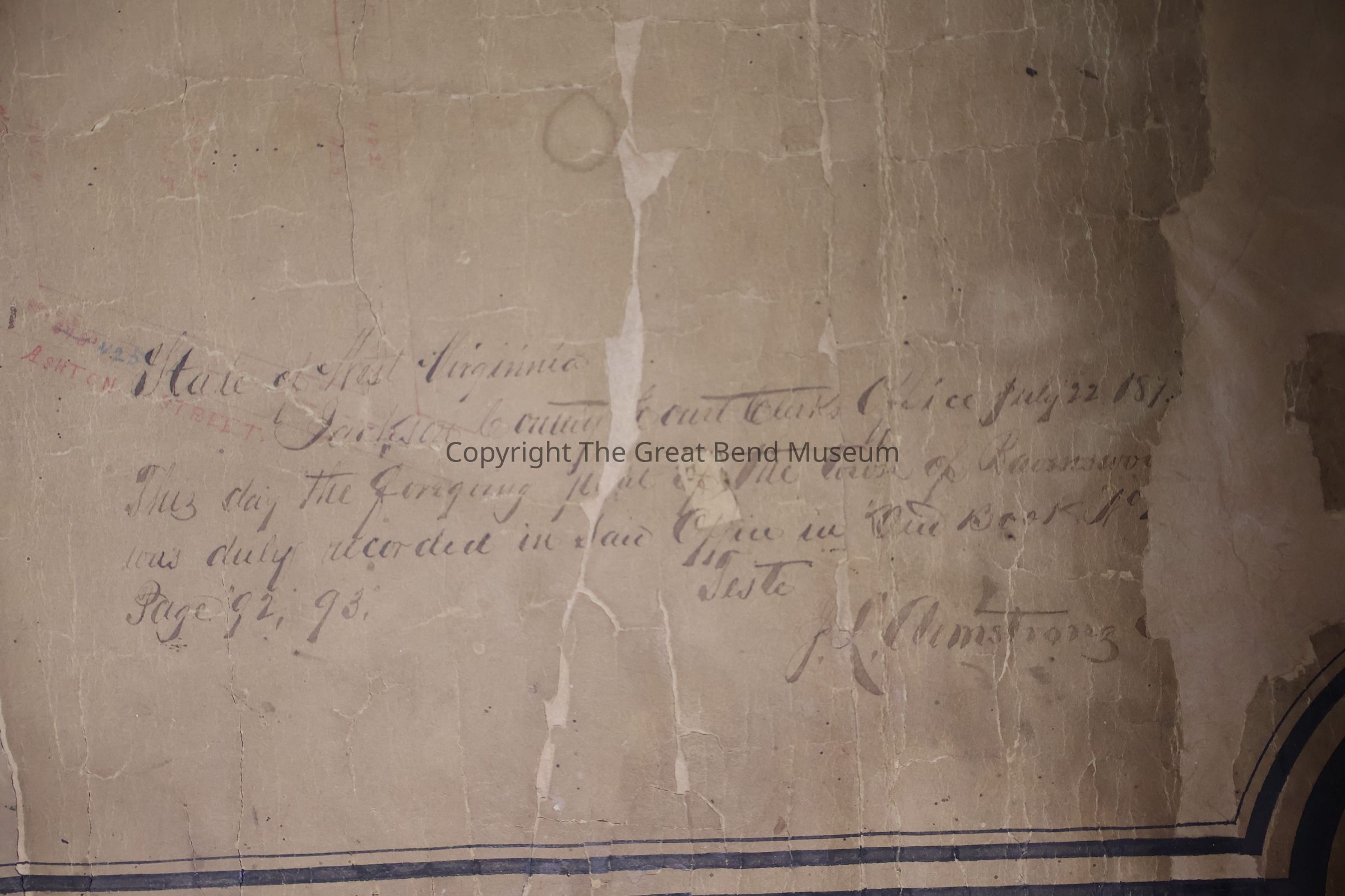
Recto, At bottom center, added laterTranscription
“That part of [illegible] on the / East of Henrietta Street was / resurveyed in Aug 1884 and / also Sycamore Street from Race / to Gallatin Street [illegible] in red ink. / J. S. A. Farrow”.Material/Technique
InkType
InscriptionLocation
Recto, At upper right, written perpendicular to direction of titleTranscription
“State of West Virginia / Jackson County Court Clerk’s Office July 22 187[illegible] / This day the foregoing plate of the town of Ravenswood / was duly recorded in Said Office in ‘Deed Book No. [illegible] / Page “92, 93.” / Teste, / J. L. Armstrong [illegible]”.Material/Technique
Ink