Notes
The map was previously treated by staff at the Library of Congress around 1949. As part of the treatment the map was cut into six segments of unequal size. Each sixth was lined to a soft wove paper with an unknown adhesive, possibly Yes! Paste. Each paper-lined component was then adhered to a large piece of canvas, again with an unknown adhesive; 1/8” gaps were left between each sixth to facilitate folding.
From the documented practices of the forerunners of the current Preservation Directorate at the Library of Congress, it is likely that the map was washed and deacidified prior to lining without regard to the solubilities of any of the writing inks. Slight haloing around a few blue ink inscriptions that likely date to the late 19th or early 20th century indicate that these inks were partially soluble in whatever solutions were applied to the map. The attached typewritten note, outlining the conservation history of the map, indicates that it was likely treated with an insecticide. The smell of the map suggests that the insecticide used may have been thymol.
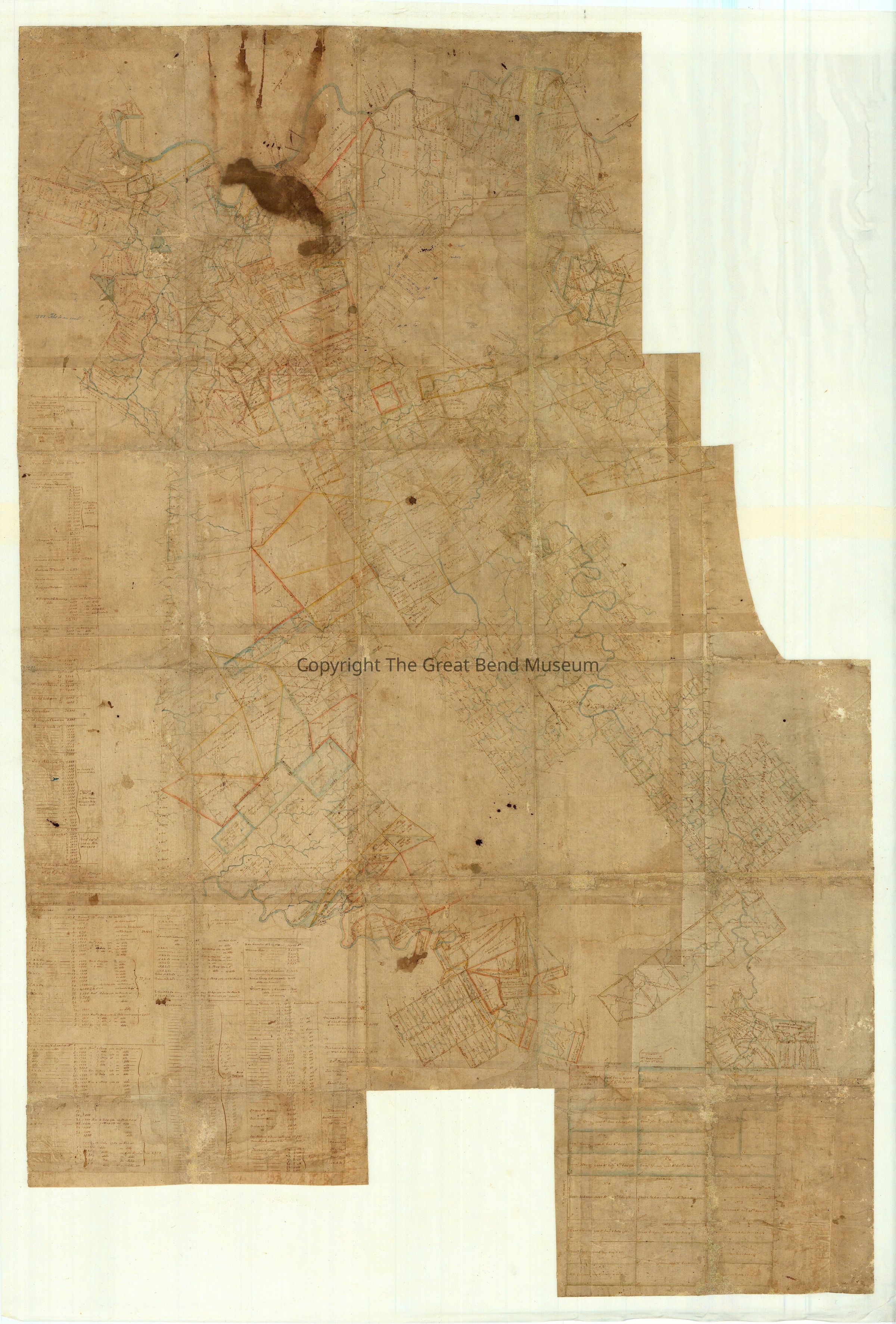
Originally composed of multiple pieces of laid paper, the current outline of the primary paper support is wildly uneven. This may have been the original format of the map, as more land was acquired, surveyed, and added to the already existing map, requiring additions or alterations to the paper support; alternately, a more rectilinear object may have been cut down as the outer, empty areas of paper became damaged. It is likely that the current shape of the primary support may be result of both possibilities - additions and removals - as the assemblage of paper sheets is uneven and areas have fragmentary text, indicating that portions are no longer extant.
The map was originally folded, with a moderate degree of loss to the primary paper support occurring along the folds and outer edges. There is some skinning and localized damage to tear/fold edges related to silverfish, but nothing extensive enough to suggest even a minor infestation. The wove paper secondary supports are lifting from the fabric lining along the corners and edges. The entire work also exhibits some minor uneven overall planar distortions, so that it does not lay flat when unfolded. There are a number of tack holes present, primarily along the perimeter of the secondary/tertiary supports, likely from a past display method.
The paper is moderately discolored overall, with some historic ink stains scattered across the surface of the map. There are a number of fly specs on the surface, which appear to be smashed into the paper primary support. There is a large dark liquid stain at the lower left quadrant of the map; this is the result of a coffee spilled by a previous owner. Surface dirt is slight/minor overall
The inks appear to be stable an in good condition, though there is some evidence of smearing/ lateral movement of late 19th century inks by the heavy treatment carried out by the Library of Congress. Preliminary testing indicates that the inks are stable in water and water/ethanol solutions.
Attached individually onto paper secondary supports are a typewritten note about the
attribution of and past treatment of the piece and a photostat. The photostat is of a simple map of property held by George Washington. Both are secured to the paper secondary supports with four pieces of pressure sensitive adhesive tape. The adhesive tape is discolored. The typewritten note is in good condition but the photostat is faded unevenly overall.