Name/Title
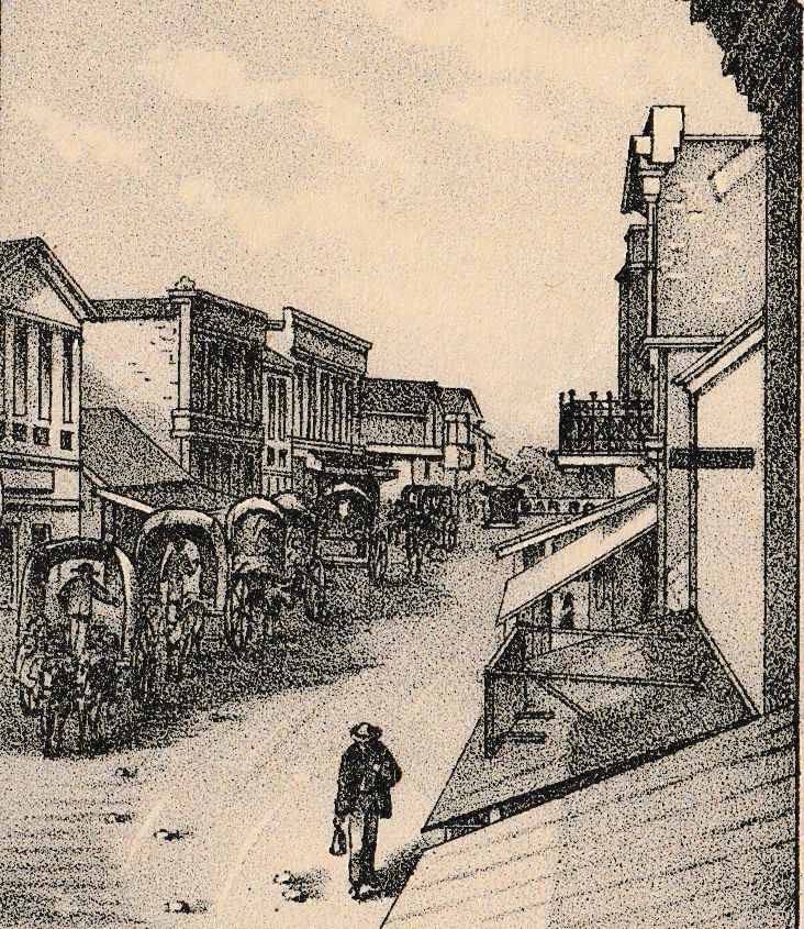
"Commerce Street, San Antonio, Tex" [Lithograph]Description
An 1876 lithograph of "Commerce Street, San Antonio, Tex" from the Galveston, Harrisburg & San Antonio Railway Company’s book “A Description of Western Texas.”Context
Life in San Antonio in the 1700s revolved around Main and Military plazas west of the river and Mission San Antonio de Valero (the Alamo) east of the river. Residents traveled between the plazas and mission along an unpaved street that led to a low river crossing. Later known as Commerce Street, the thoroughfare was lined with small houses and stores until the late 1800s when multi-story limestone and brick structures transformed downtown. To accommodate increased cross-town traffic, a narrow bridge was replaced by a wider iron span in 1890, and in 1914 the present concrete bridge was constructed. It was not until the early 1900s that city leaders began to clear the overgrown river to create a linear park. Architect Robert H.H. Hugman’s plans to further enhance the river with walkways and landscaping were implemented from 1939 to 1941, creating the River Walk.
“A Description of Western Texas" is an extensively illustrated guide for prospective immigrants to western Texas. Published by the Galveston, Harrisburg & San Antonio Railway Company in 1876, the text provides descriptions of the cities, towns, and counties of western Texas, complemented by additional information on a variety of topics of interest for those considering a move to the region. Executed in an accomplished, understated style, the lithographs serve as a marvelous invitation to the region.
Eberstadt called the book "a valuable description of the lands, towns, agricultural prospects of West Texas, of high interest for the lithographic views."