Name/Title
Aerial picture of flood approaching RexburgDescription
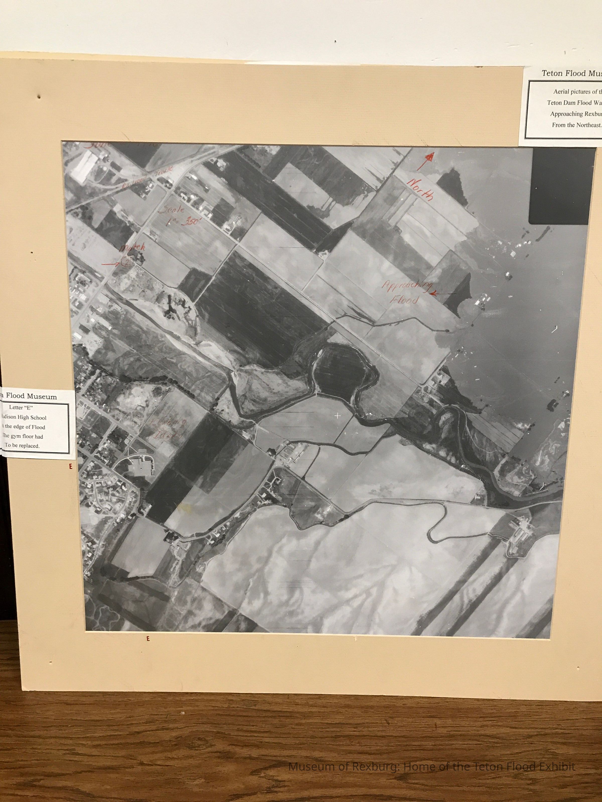
This photo is 28.25x28 inches and is a black and white aerial shot of the flood approaching Rexburg. It has red writing on the photo saying where things are and on the mat there are letters to be able to find different locations. On the front it says, June 5, 1976 Rexburg, Idaho, During Flood Scale 1"=350'. The railroad tracks and the main highway is labeled on the photo. The words Teton Flood Museum Aerial pictures of the Teton Dam Flood Waters Approaching Rexburg from the Northeast are in the right hand corner. The words Teton Flood Museum Letter "E" Madison High School at the Edge of Flood They Gym Flood Had To Be Replaced are in the center left edge. The words approaching flood and north are also listed in red on the photo.