Name/Title
خريطة إسرائيل كما قدمت لمؤتمر السلام 1919Entry/Object ID
0001.01.0329Description
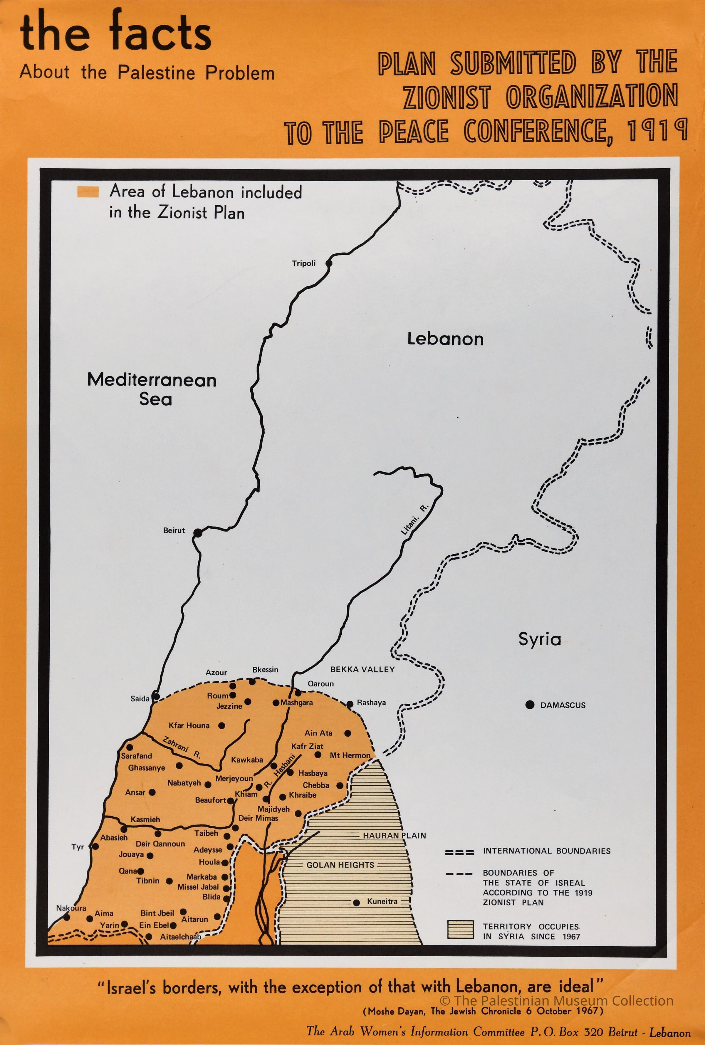
ملصق ملون، يظهر فيه خارطة لبنان وقد تم اضافة الجزء الجنوبي منها الى فلسطين، بإعتبارها جزء من دولة الاحتلال "اسرائيل"، تم تقديم هذه الخريطة خلال مؤتمر السلام عام 1919.
A colour poster showing the map of Lebanon; with the addition of South Lebanon to Palestine, as a part of the State of the Occupation "Israel". This map was submitted at the Peace Conference of 1919.Dimensions
Width
32.8 cmLength
48.3 cm