Name/Title
Johnson's maps of Ireland and ScotlandEntry/Object ID
2024.005.175Tags
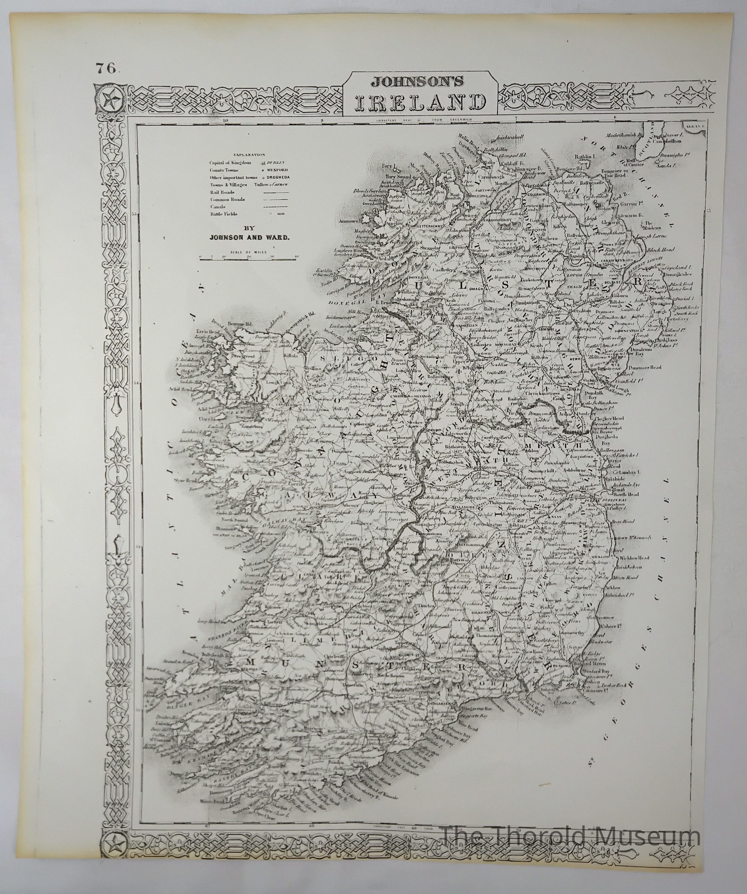
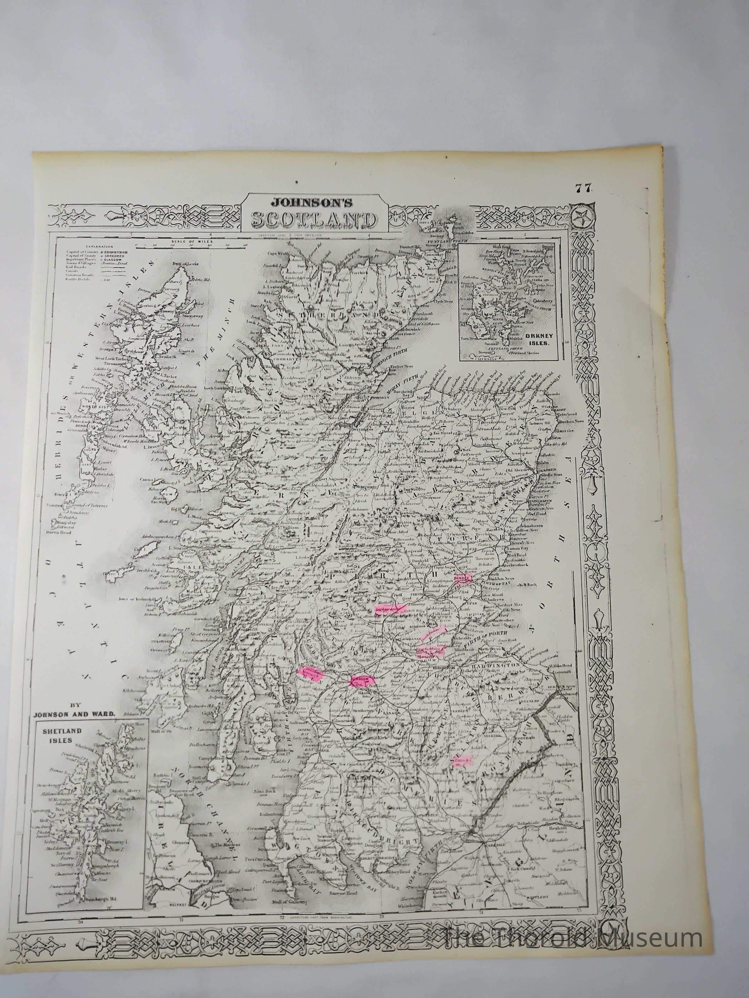
MAPSDescription
Two pages, page 76 and 77 from an unknown publication, depicting mapsCataloged By
Victoria StewartMap Details
Maker or Creator
Johnson and WadeScale
MilesTime Period
20th CenturyPublication Language
EnglishMap Notes
Map A shows Ireland, map B shows ScotlandInscription/Signature/Marks
Type
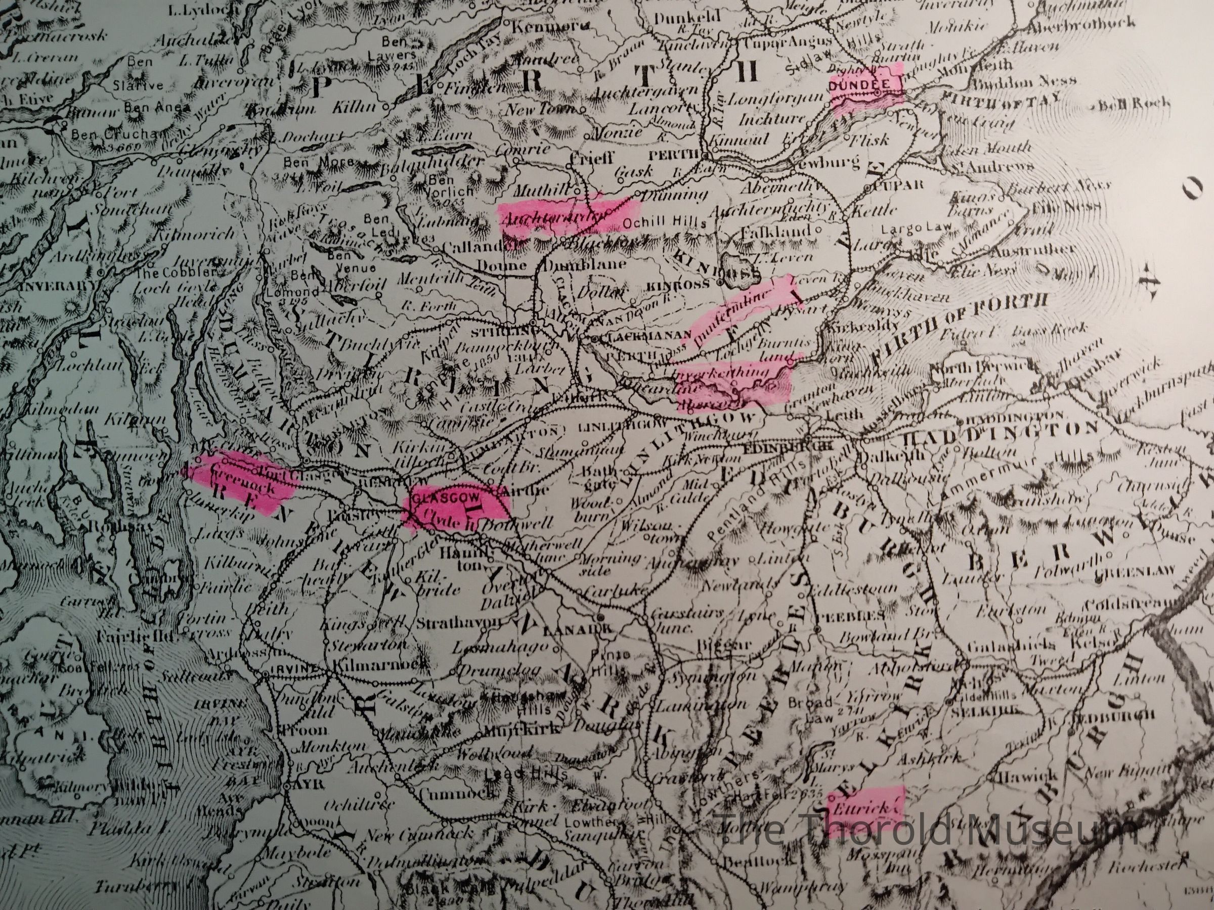
HighlightsLocation
Lower half on the front of map BNotes
Highlights these places
Dundee
Ettricks
Greeuock
-Uncerain-
Dunfermline
-Uncerain-
-Uncerain-
Glasgow
Clyde HParts
Count
2Parts
Map A - Ireland, map B - Scotland