Name/Title
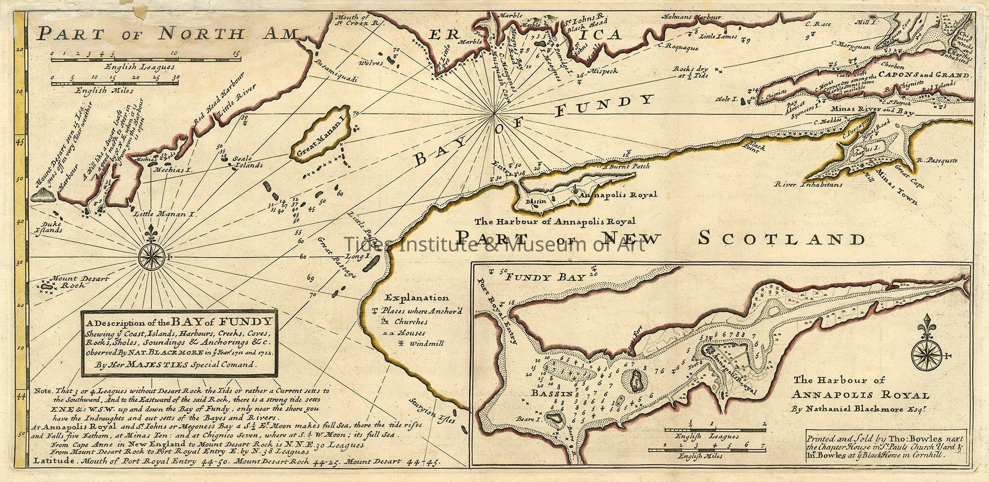
A Description of the Bay of Fundy | Herman Moll and Nathaniel BlockmoreDescription
Artist: Herman Moll and Nathaniel Blockmore
Classification: Maps
Circa: 1745
Old Accession Number: 916
Description:
MOLL, Herman (1654-1732); & Nathaniel BLACKMORE A Description of the Bay of Fundy shewing ye coast, islands, harbours, creeks, coves, rocks & sholes, soundings & anchorings &c. Observed by Nat. Blackmore in ye year 1711 and 1712. by Her Majesties Special Command London: Printed and sold by Tho: Bowles next the Chapter House in St. Pauls Church Yard & Ino. Bowles at ye Black Horse in Cornhill, [circa 1745]. Copper-engraved map, period hand colouring in outline. Inset of "The Harbour of Annapolis Royal by Nathaniel Blackmore Esqr". Sheet size: 9 3/8 x 19 1/8 inches. An attractive map of the Bay of Fundy by one of the greatest cartographers of the eighteenth-century.