Name/Title
Calais Observatory | Calais MaineDescription
From Calais Observatory National Register Nomination Form:
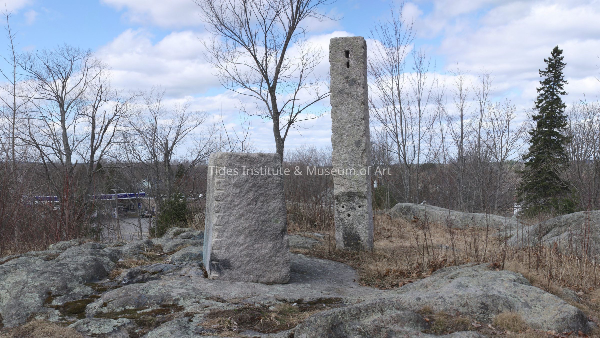
The site of the former Calais Observatory is an elevated granite rock outcrop in the city of Calais. The site occupies a portion of a small park owned and maintained by the city. Meridian Park is bound on the west by North Street, (U.S. Route 1), on the south by Lincoln Street and on the north by Academy Street. The southeastern edge of the park abuts the town-owned Calais Community Center (a former school gymnasium) and the Calais Grade School. The southwestern edge of the park ends at the property line of residences that face southerly towards Lincoln Street, or easterly toward Calais Avenue. The outcrop is essentially centered within the park, almost directly west of the Community Center. West of the outcrop a gravel driveway exits Lincoln Street, skirts the base of the stone hill, and curves northeast to a large parking area west of the Community Center. Between this drive and Route 1 the park has lawn, mature trees and some landscaped gardens. East of the outcrop are mostly overgrown shrubs, while a wide strip of grass shaded by a line of mature maple trees lie adjacent to Lincoln Street. The un-even outcrop hosts tall grasses, shrubs, birch clusters and young maple trees. Located at the highest point of the outcrop are a stone pillar and stone base, as well as two drill holes and a pair of stone pads chiseled out of the granite. These items, upon which were fastened instruments for determining longitude, constitute the remains of the Calais Observatory. The Observatory was utilized periodically between 1857 and 1895. While the instruments were removed when the Observatory was not in use, a small building had been erected in 1857 to shelter the site, and it was still extant in 1866. However, no mention of it is found with reference to the 1895 measurements taken at the site.