Name/Title
MapEntry/Object ID
2007.2.34Tags
Books and DocumentsDescription
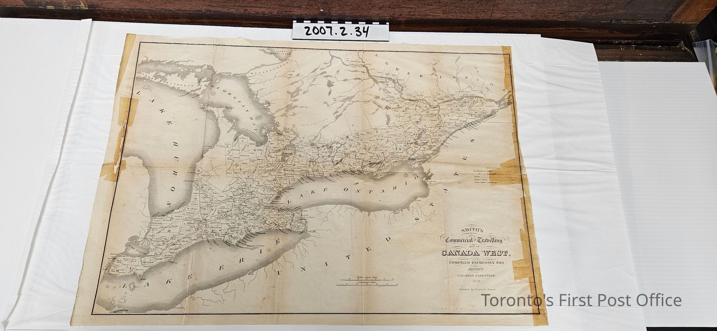
Map entitled "Smith's Commercial and Travelling Map of Canada West, Compiled Expressly for Smith's Canadian Gazateer 1847. Published by H. Rowsell. Toronto"; black and grey on very thin white paper (onionskin?); five previous fold lines; illustrates boundaries of Districts and Townships, Roads, District Towns, Other Towns and Villages; scale for British Statute Miles and Geographical Miles.Update Date
September 6, 2025