Name/Title
Glass Factory Map Circa 1804 to 1818Entry/Object ID
2021.2.79Description
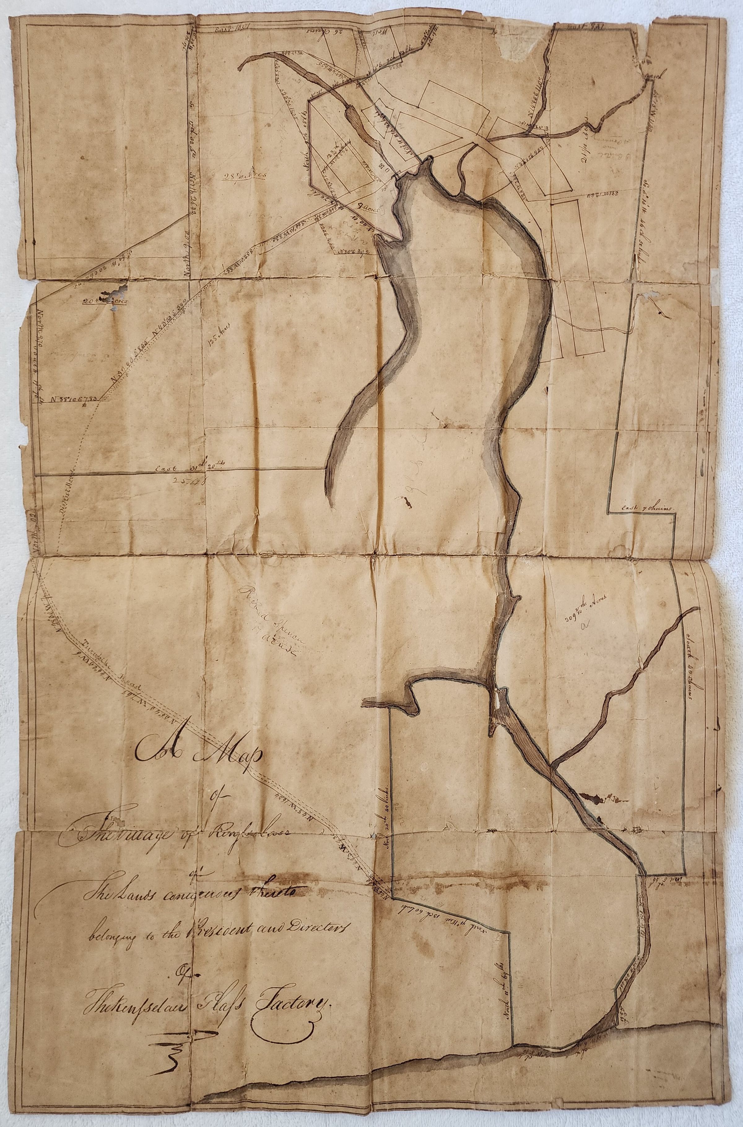
Original approximately 18" x 30" hand-drawn map on parchment of Glass Lake, the "Rensselaer Glass Factory," and its village apparently before it was called "Glass House" village. Entitled, "A Map of The Village of Rensselaer belonging to the President and Directors of the Rensselaer Glass Factory." Interestingly refers to Rensselaer Village before it became known as Glass House village which dates it to approximately 1804 to 1814. The map is part of and stored along with the "St Pierre & Shepard Faith Mills Document Collection," which additionally includes high-resolution photos of each quadrant of the map. Refer to that entry in the Faith Mills section of this system for more information.Cataloged By
Michael Frederick PerryAcquisition
Accession
2021.2Acquisition Method
FoundCreated By
curator@slhstrustees.orgCreate Date
November 2, 2022Updated By
curator@slhstrustees.orgUpdate Date
November 2, 2022