Name/Title
Hand Drawn Map of Pre-Van Vlack Historic Sites 1790's to 1869Entry/Object ID
2024.789.1Scope and Content
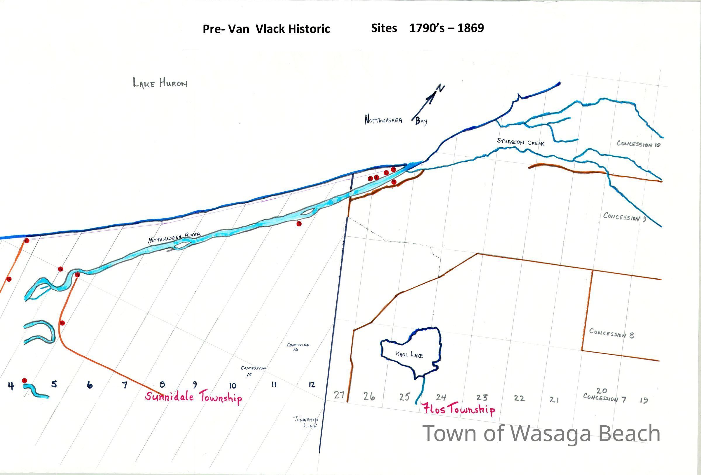
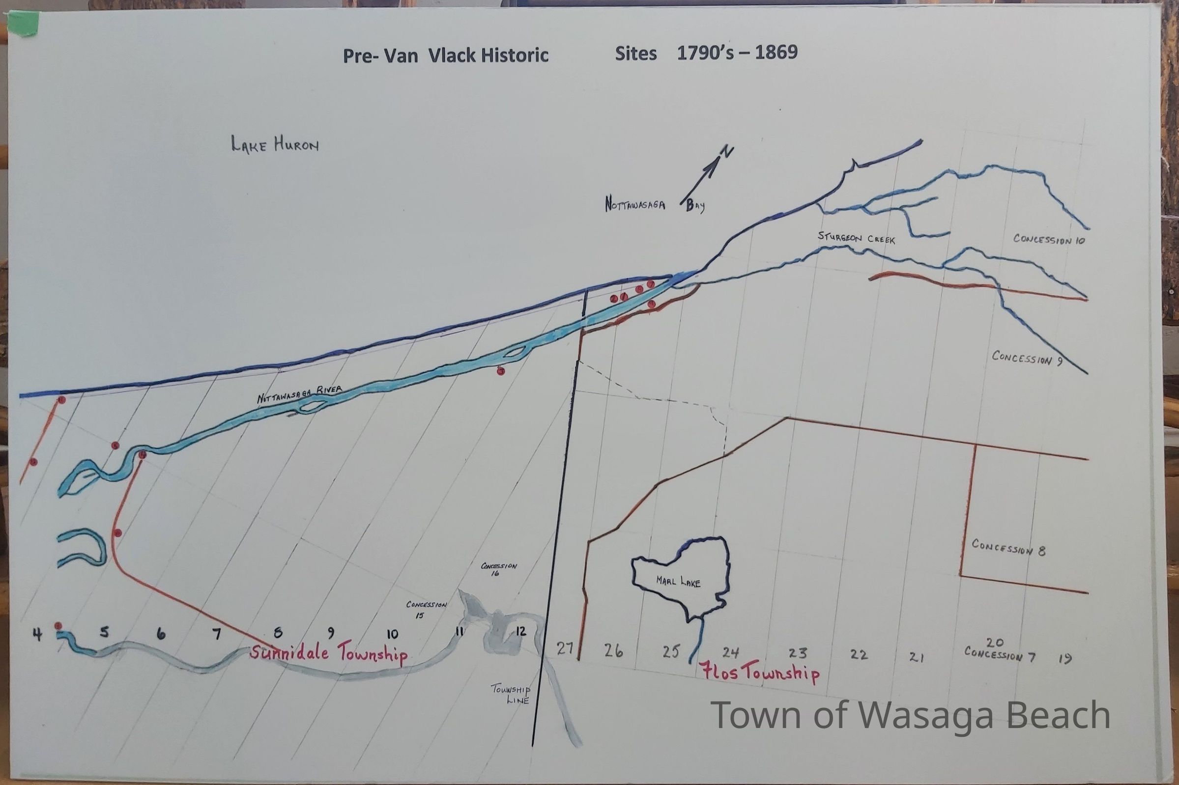
Hand drawn map of pre-Van Vlack historic sites, 1790's -1869, researched and drawn by Archives volunteers Karen Bowles and Terry Olaskey.Acquisition
Accession
2024.789Source or Donor
Karen Bowles, Terry OlaskeyAcquisition Method
GiftDimensions
Height
24 inWidth
36 inDepth
1/4 in