Name/Title
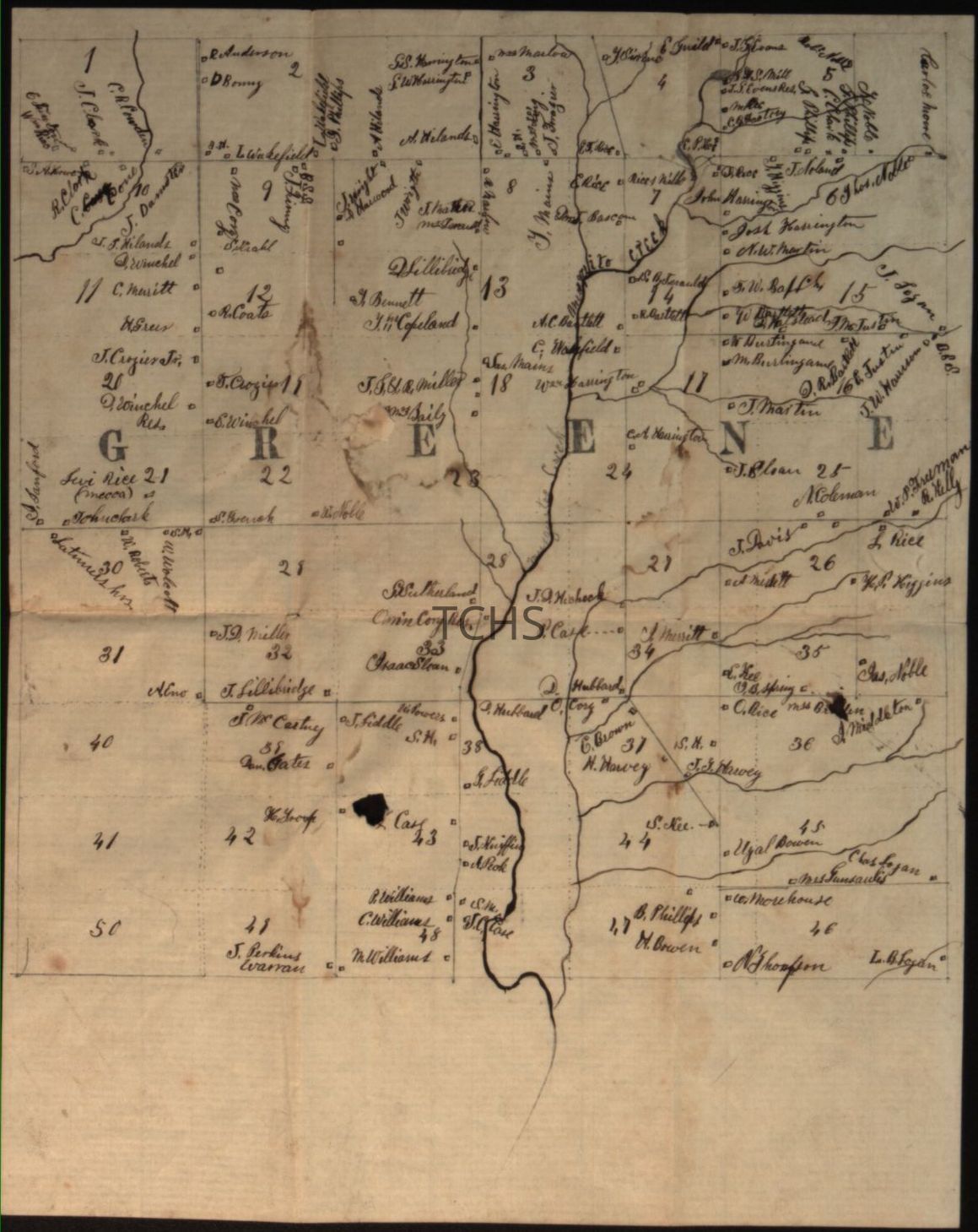
1850s Greene MapEntry/Object ID
2025.35.11Tags
1850sScope and Content
1850s map of Greene township drawn by Lewis Harrington (1830-1884). Created while Harrington studied at Ashtabula County Institute of Science and Industry, this meticulously detailed map (7.75"x9.75") documents waterways and family landholdings, including those of the Harrington family.
The son of Revolutionary War veteran John Harrington and Rhoda Key Harrington, Lewis Harrington trained as a civil engineer before helping found Hutchinson, Minnesota, where he later served in the state legislature. The reverse features an intriguing pencil sketch of an unidentified settlement with family names and waterways.Acquisition
Accession
2025.35Source or Donor
Jensen, DanAcquisition Method
GiftLocation
Location
Box
Trumbull County Places Box 2Building
Morgan History CenterDate
July 28, 2025Relationships
Related Person or Organization
Person or Organization
Harrington, LewisResearch Notes
Research Type
Needs further research