HUB
Collections
Classifications
About
App
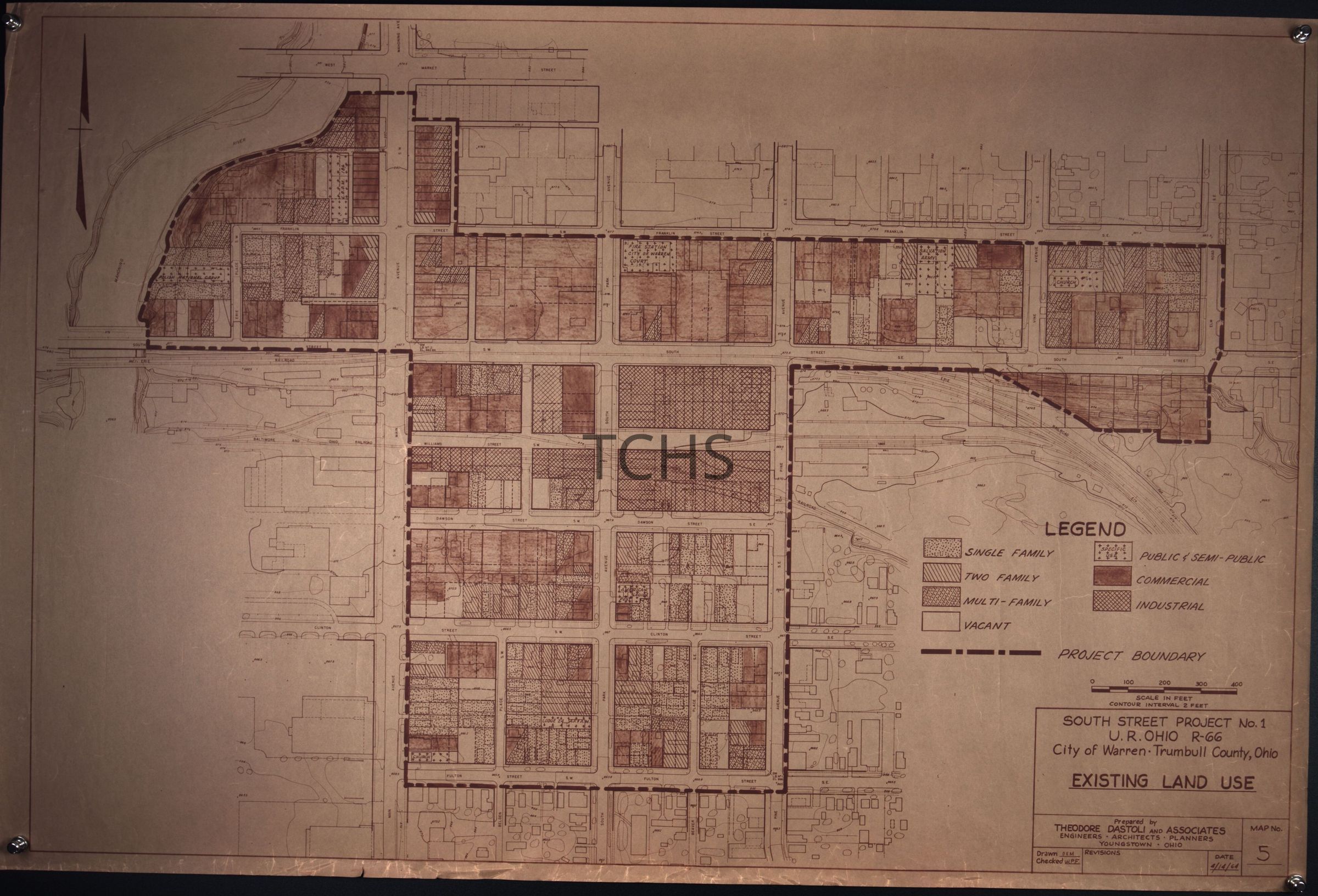
South St Project No. 1 U.R. Ohio R-66: Existing Land Use
Map
-
Trumbull County Historical Society
Name/Title
South St Project No. 1 U.R. Ohio R-66: Existing Land Use
Entry/Object ID
2021.20.71
Tags
Architecture,
1960s
Description
South St Project No. 1 U.R. Ohio R-66: Existing Land Use, dated April 14th, 1964, and prepared by Theodore Dastoli and Associates.
Collection
Urban Renewal
Acquisition
Accession
2021.20
Acquisition Method
Gift
Map Details
Maker or Creator
Theodore Dastoli and Associates
Place Published
* Untyped Place Published
Warren, Ohio
Date Published
Apr 14, 1968
Location
Location
* Untyped Location
Urban Renewal Maps Box 1
Date
March 1, 2025
Relationships
Related Person or Organization
Person or Organization
Theodore Dastoli and Associates
Related Places
Place
* Untyped Place
Mahoning Avenue, Warren,
Market Street,
Warren, Ohio,
Park Avenue
Street
Franklin St. S.E.,
Erie Pl.,
South St.,
Pine Ave.,
Fulton St.,
Belden Pl.,
Main Ave. S.W.
Related Events
Event
Urban Renewal