Name/Title
Map of the Hetch Hetchy and Yosemite Valleys Ry. Situated in Tuolumne County California Lands of the West Side Flume and Lumber Co.Entry/Object ID
M13722Scope and Content
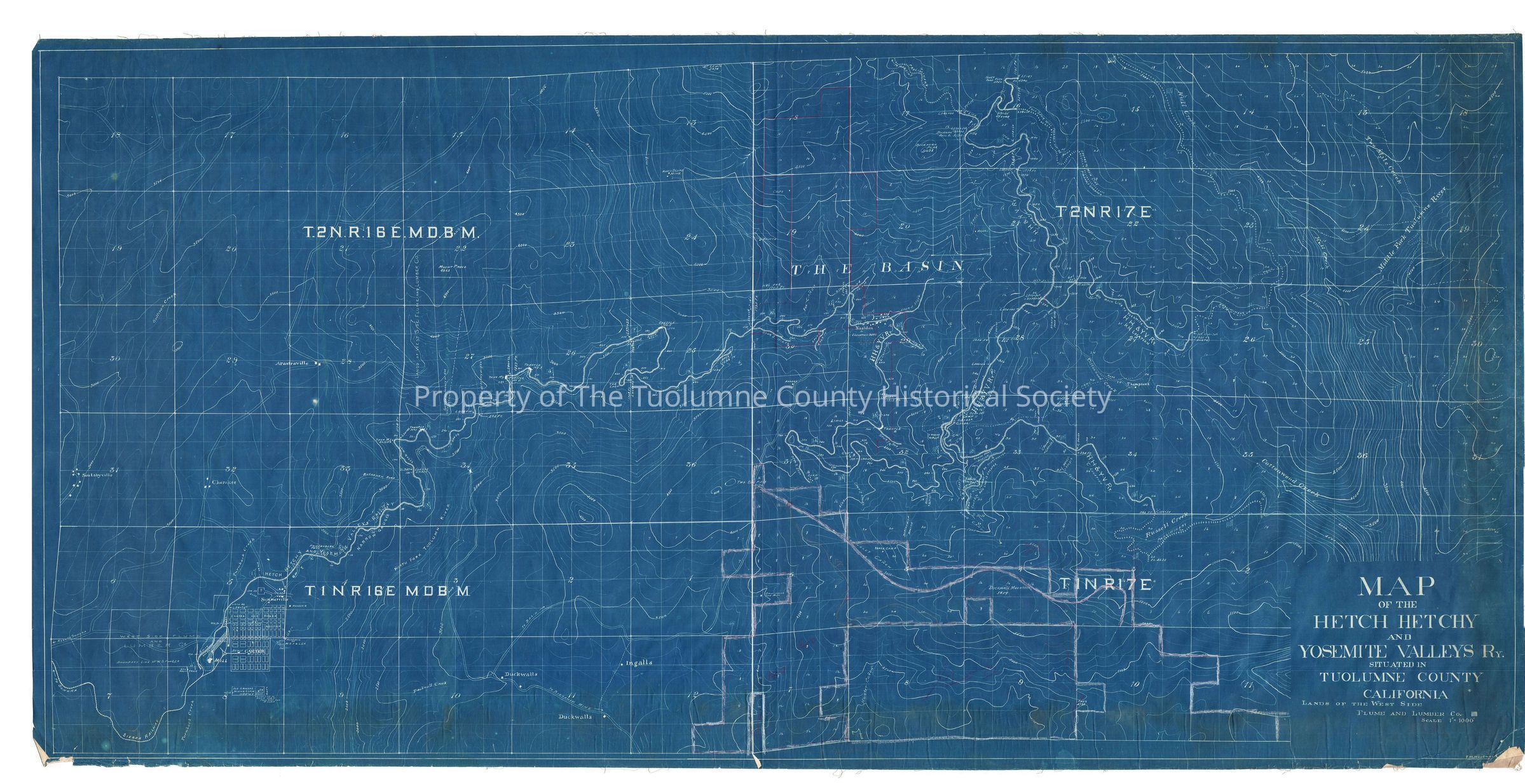
Large blue-print map showing ROW from Tuolumne to approximately one mile east of Deadwood; prepared by F.M. Woodman (Kauppi description)
Large detailed blueprint map of the Hetch Hetchy & Yosemite Valleys Railway. While actually a logging railroad, the company continued for many years to try to keep alive the image of being a regular passenger carrying railroad, even though they never carried any passengers other than crew or on special occasions a gala special using flat cars to carry the public to the woods for a picnic. Kriegs book "Last of the 3 Foot Loggers", shows a photo of two such trains on River bridge stopped while photograpers set up for pictures.
This a map of great detail. The map displays the trestle numbers, the spur numbers, the water tank numbers, and the camp numbers. Nashton is displayed as an important location with several buildings. Citing Allan Krieg again , Nashton was the site of Camp 8 and until 1905 was the site of the company's shops where the 24 foot log cars were maintained. It was a fair sized community with a school and a post office. Krieg also states that there are no maps which show a location for camp 11 since it was frequently moved from year to year. This map is interesting because it shows a location for camp 11.
The Northern spur terminates at Fahey Mdw. The mainline terminates on the section line between sections 26 and 27, T2N R17E. A southern spur terminates on the ridge north of Russell Creek which is tributary to Cottonwood Creek. (Rutty description)
Scale: 1 inch = 1000 feetCollection
Standard Lumber Company Collection