Name/Title
Exhibit J Showing Location of Railroad of the Hetch Hetchy & Yosedmite Valleys Railway Company of CaliforniaEntry/Object ID
M13724Scope and Content
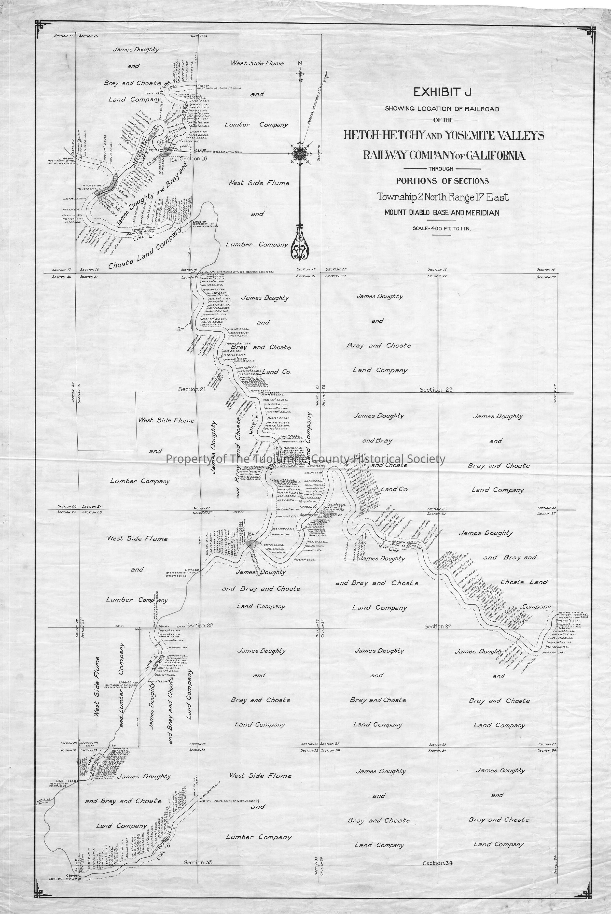
early detailed map showing ROW in vicinity of Dry Tank
(Kauppi description) (where's dry tank?)
The railway enters the map from the west in section 32, about two miles east of Two Dog pass. The first divergent in section 32 we're told is headed to Willow Meadow (see notation in section 33 at end of track.). It is ther only true landmark mentioned on the map, which is disappointing.
The next junction is in the NE corner of section 28. Its labeled the "HH Line". Looking at a modern map and comparing section lines it seems that the HH Line is going down Cottonwood Creek probably close to the water whhile the main line is going up Cottonwood Creek but stayiong higher up on the ridge. By the time we get to the "Y" Line or to the end of the northern most section in section 16 we are in Fahey Meadow. (Comparing to a modern map).
Scale: 1 inch = 400 feet
Location: Cottonwood Creek
Township/Range/Section: T2N R17E sections 16, 21, 22, 27, 28, 32, 33.Collection
Standard Lumber Company CollectionLexicon
Search Terms
railway right of way survey, Hetch Hetchy & Yosemite Valleys Railway, Cottonwood Creek, Willow Meadow, Fahey Meadow