Name/Title
Hetch Hetchy & Yosemite Valleys Railroad Right-Of-Way MapEntry/Object ID
M13729Scope and Content
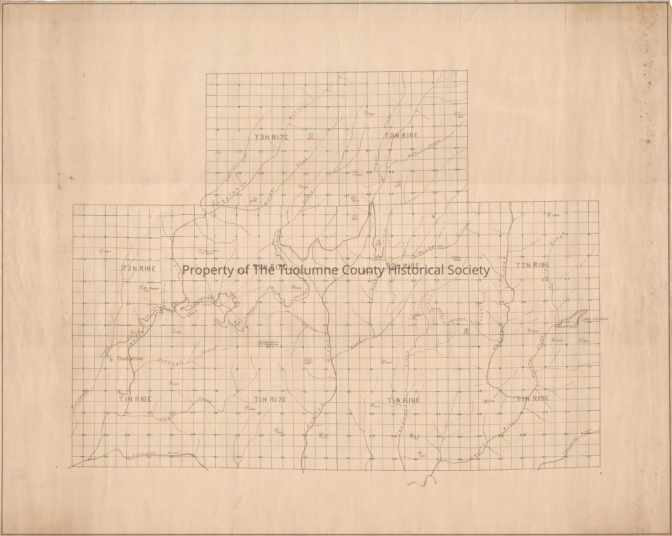
Small-scale map showing trackage from Tuolumne to just short of Reed Creek. Proposed trackage is shown to the Cherry Creek drainage.
The map depicts mainline tracks but no spurs crossing Turnback Creek, North Fork of the Tuolmne River, Hull Creek, Clavey River, Reynolds Creek, Reed Creek, and Jawbone Creek and ending at Cherry Creek.
There is no map legend.
Location: Tuolumne County - Tuolumne to Lake Eleanor
Township/Range/Section: T3n R17E, T3N R 18E, T2N R16E, T2N R17E, T2N R18E, T2N R19E,Collection
Standard Lumber Company CollectionLexicon
Search Terms
railroad, Route map, forest/map, Creeks, Rivers, Hetch Hetchy & Yosemite Valleys Railroad, North Fork of the Tuolumne River, Clavey River, Turnback Creek, Hull Creek, Reed Creek, Reynolds Creek, Jawbone Creek, Cherry Creek