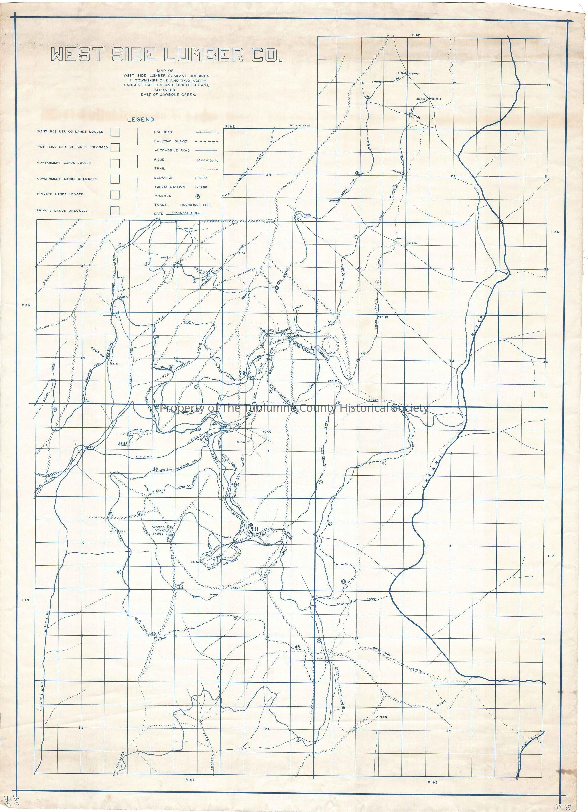
West Side Lumber Co. Holdings and Township 1 and 2 NE of Jawbone and Ranges Eighteen and Nineteen East, Situated East of Jawbone Creek

Name/Title

West Side Lumber Co. Holdings and Township 1 and 2 NE of Jawbone and Ranges Eighteen and Nineteen East, Situated East of Jawbone Creek

Entry/Object ID

M13731

Scope and Content

Map traces mainline of the railroad from Skunk Creek (mile post 56) to Woods Ridge (mile post 64). From there the map shows planned trackage to the Cherry Creek drainage at mile post 70. This map also shows the Cottonwood dirt road from (Tuolumne) Skunk Creek at the mapedge, to the Woods Ridge Lookout tower. Taking a turn to the South at a junction near Sand Flat Creek that road goes to the Jawbone Ranger Station (Groveland Ranger District, Stanislaus National Forest). The map gives a lot of good information on items such as the location and name of the many spurs, the location of water and fuel oil tanks and the mile posts. (mileage from starting point,Tuolumne) It also includes the location of Camps 40, 41, 42, and 43. It also gives the grade of the railroad, as well as the elevation of end of track of the spurs. Scale: 1 inch = 1000 feet Location: Tuolumne County - East of Jawbone Creek Township/Range/Section: T1N R18E Secs 1,to 3,10 to 14,15, 22 to 24 T2E R19E Secs 5, 17 to 19 T2N

Collection

Standard Lumber Company Collection

Lexicon

Search Terms

forestry/map, Creeks, Forestry/Trees, Logging, Lumber Companies, Railroads, Ranger Stations, Skunk Creek, Crane Creek, Woods Creek, Jawbone Creek, Wet Meadow Creek, Cherry Creek, Sand Flat Creek, Woods Meadow, Crane Meadow, Granite Creek, Railroad grades, railroad spurs, oil tanks, water tanks, mileposts, camps, Map of West Side Lunber Company Holdings Eas of Jawbone Creek