Lands of the West Side Lumber Co. Situated in Tuolumne County California

Name/Title

Lands of the West Side Lumber Co. Situated in Tuolumne County California

Entry/Object ID

M15026

Scope and Content

Includes West Side Lumber Co right-of-way from Tuolumne to vicinity of Camp 12 (Cottonwood Creek) The Town Of Tuolumne is still listed as Carters on the map. The railroad winds up the North Fork of the Tuolumne River and crosses into Basin Creek. From there it winds its way up to Cottonwood pass. Here the planned mainline route is north to Wrights Creek and Hull Creek. The track however has been built out along a high ridge above Cottonwood Creek at this point in time. (Estimated as being 1906) Township/Range/Section: T3N R17E T3N R18E T2N R16E T2N R17E T2N R18E T2N R19E

Collection

Standard Lumber Company Collection

Lexicon

Search Terms

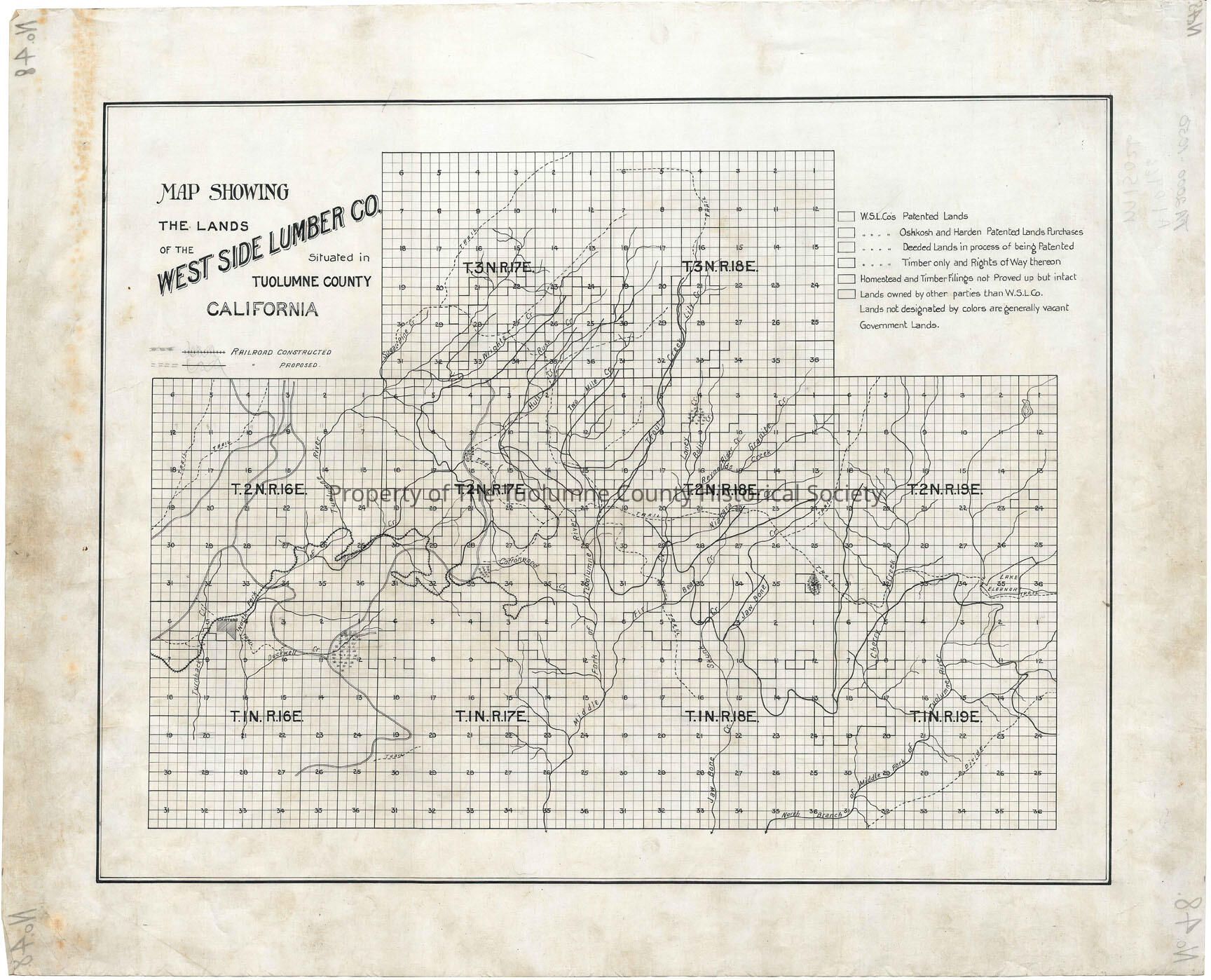
forest map, logging industry, logging railroad, West Side Lumber Co., Buchanan Road, Cottonwood Road, North Fork Of The Tuolumne River, Basin Creek, Wrights Creek, Rush Creek, Hull Creek Two Mile Creek, Lilly Creek, Trout Creek, Loney Creek, Reynolds Creek, Niagara Creek, Bear Creek, Jawbone Creek, Middle Fork of the Tuolumne, Cherry Creek, Skunk Creek, Railroad progression