Name/Title
Agricultural and Grazing Lands, of the West Side Lumber Co.Entry/Object ID
M15027Scope and Content
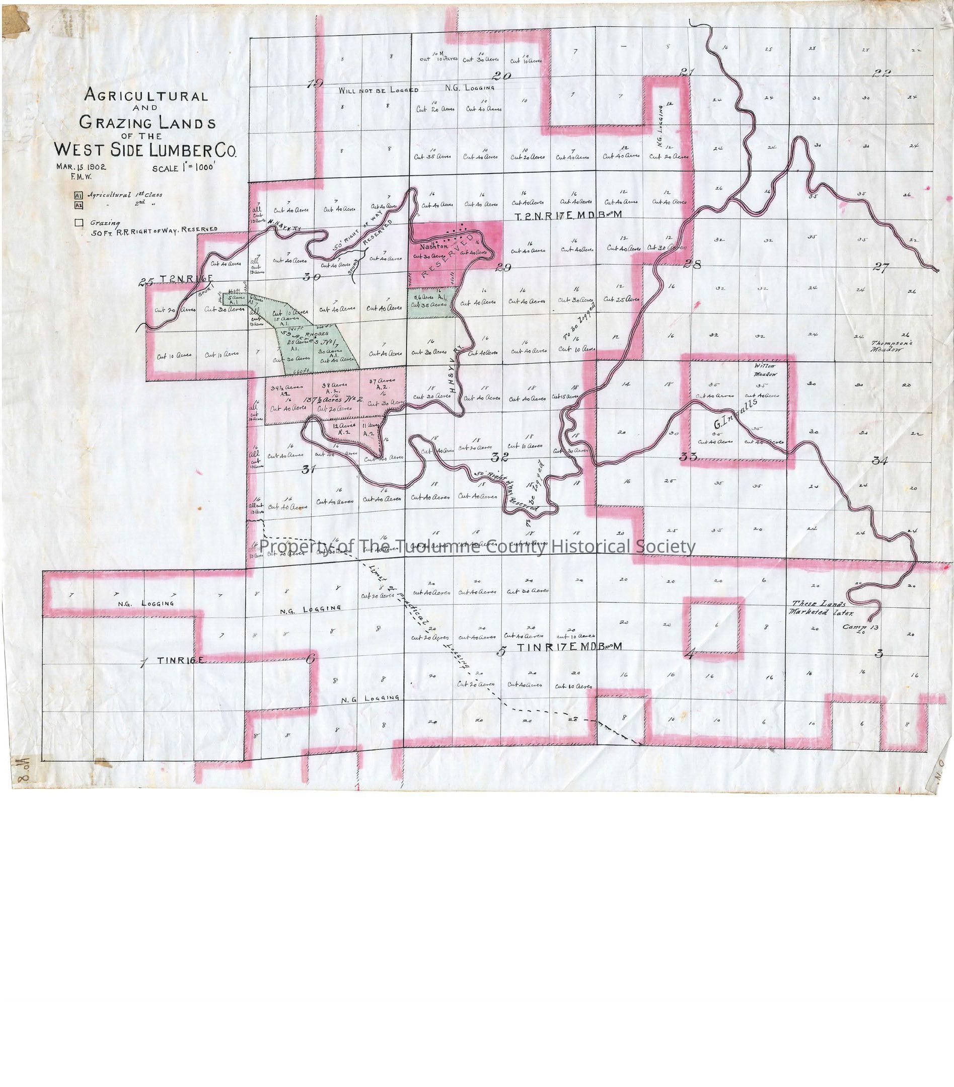
Shows ownership of grazing land in vicinity of Camp 8 to Deadwood
The map is color coded. Green is Agricultural 1st class lands. Red is Agricultural 2nd class lands. Within the area displayed only two areas are shown to be 1st class agricultural lands. Roughly 20 acres in section 29 of T2N R17E and 110 to 120 acres in section 30 of T2N R17E. 137 acres is shown in section 31 as separate category #2 lands. Suspect its a private land owner other than West Side Lumber Co. The name Rhodes is entered there. In section 29 at a location along the railroad tracks called Nashton is a 70 acre block Reserved as a category 2 agriculture area.
Note that all the West Side lands are color coded in red at their margins to indicate they are in category 2 status.
The NE 1/4 of section 33 in the same Township and Range is marked as belonging to G Ingalls. Note that the railroad passes through that block of land.
Most of the company lands are blocked into 40 acre blocks with the notation cut 40 acres. Some are reduced acres where the blocks are smaller or there is too probably too much rock or something. Some are marked "Will Not Be Logged" and some others to the south are "These Lands Marketed Later".
The Tracks are marked as having a 50 ' right of way.
Camp 13 is at the end of track in section 3 T1N R 17E.
Scale: 1 inch = 1000 feet
Township/Range/Section: T2N R17E, T1N R16E, T1N R17ECollection
Standard Lumber Company CollectionLexicon
Search Terms
forest map, logging industry, railroad logging, West Side Lumber Co., Hetch Hetchy & Yosemite Valleys Railroards, Camp 13, G Ingalls, Rhodes, Agricultural & Grazing Lands of the West Side Lumber Company