Lands of Pickering Lumber Co.

Name/Title

Lands of Pickering Lumber Co.

Entry/Object ID

M15028

Scope and Content

Shows railroad (Hetch Hetchy & Yosemite Valleys Railroad right-of-way from Tuolumne to Lost Creek one drainage beyond Bourland Creek. The W R Pickering map shows the location of Camp 8 just short of the 11 mile marker on a side drainage of Basin Creek. Camp 21 is found at the beginning of Hull Creek at the 22.5 mile post. Camp 24 on a side drainage of the upper north side of Hull Creek at the 29 mile marker. Camp 29 is located at the 40.5 mile marker on the major ridge where 76 Creek breaks from Reed Creek. Scale: 1inch = 4000 ft Township/Range/Section: T3N R17E, T3N R18E, T2N R16E T2N R17E T2N R18E T2N R19E Tuolumne County- Tuolumne to Cherry Creek

Collection

Standard Lumber Company Collection

Lexicon

Search Terms

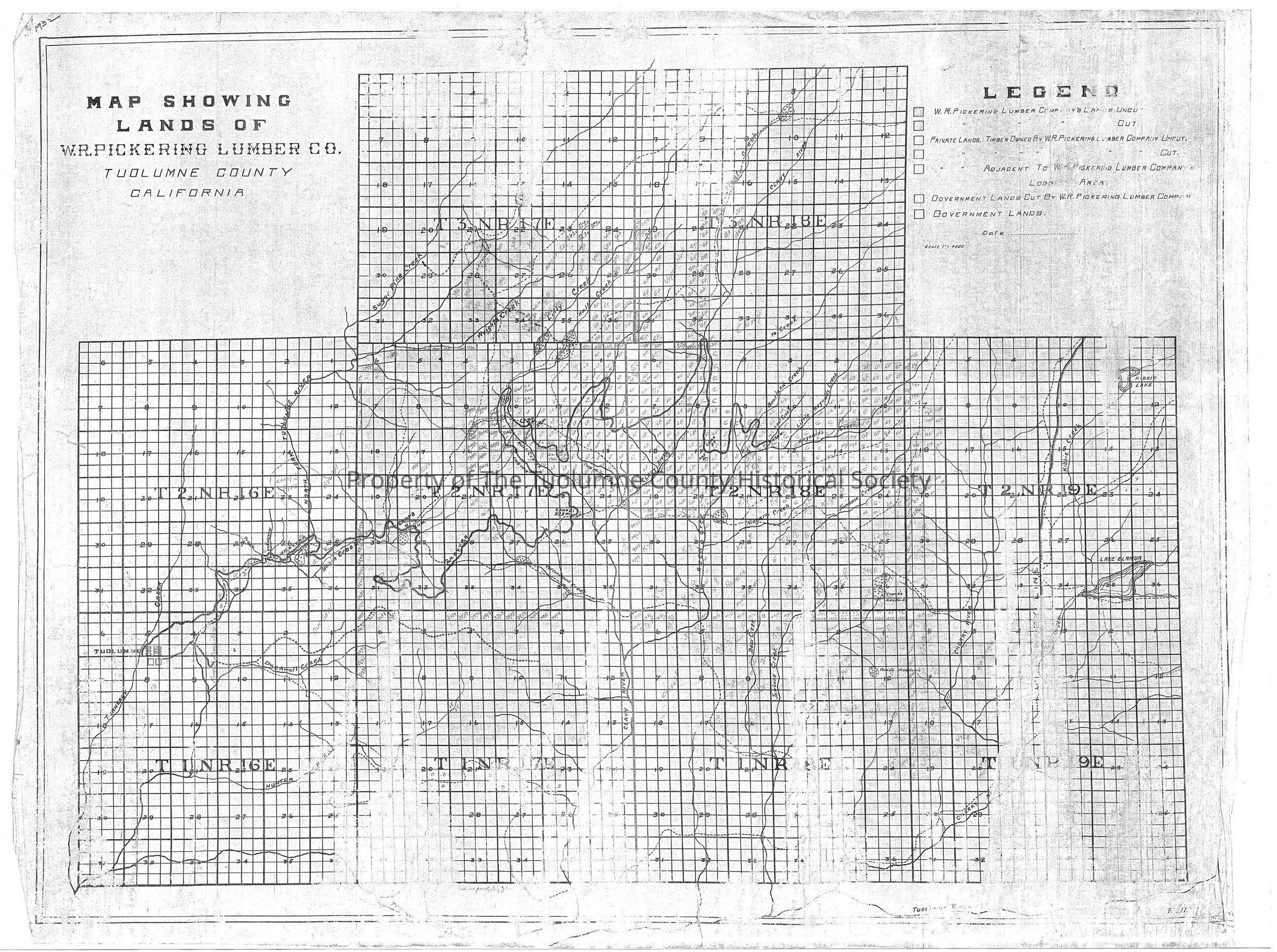
forest map, logging industry, railroad logging, Hetch Hetchy & Yosemite Valleys Railroad, Turnback Creek, Hunter Creek, Duckwall Creek, Basin Creek, North Fork Of The Tuolumne River, Clavey River, Jawbone Creek, Bear Creek, Reed Creek, Cottonwood Creek, Hull Creek, Two Mile Creek, Niagara Creek, Bourland Creek, Lost Creek, Little Reynolds Creek, Reynolds Creek, Pickering Lumber Company, West Side Lumber Company, Lands of Pickering Lumber Company