Timber Available for Railroad Operation

Name/Title

Timber Available for Railroad Operation

Entry/Object ID

M15029

Scope and Content

Color-coded diagram (not a scale map) showing actual and projected railroad timber harvesting for various tracts including--but not limited to--Trout Creek Unit, 76 Creek Unit, Reynolds Creek Unit, Camp 43 Unit and Reed Creek Unit. Timber species have colors assigned to them and are displayed after each numeration as a visual display. At the bottom of the map is a display totaling for the whole map. Sugar Pine 62,154, Ponderosa Pine 139, 553, Fir (White and Red) 156, 735). I believe the numbers are all in millions of board feet. Many of the logging Camp locations are depicted, Camps 8, 9 Deadwood, Camp 21, 24, 27 Camp 30, 36, 40 43, 44 and Camp 45. Scale: none

Collection

Standard Lumber Company Collection

Lexicon

Search Terms

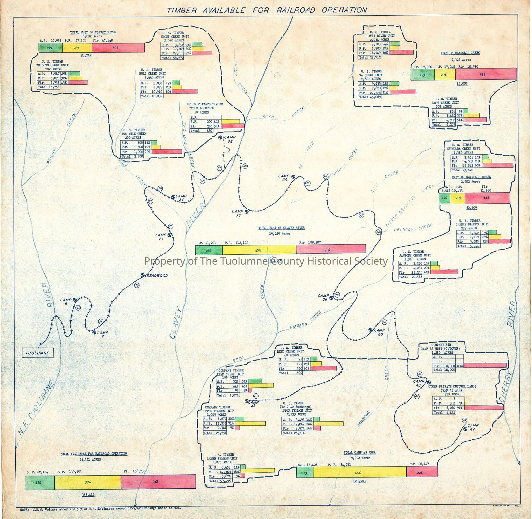
forest map, logging industry map, North Fork Tuolumne River, Clavey River, Reed Creek, Niagara Creek, Jawbone Creek, Cherry Creek, 76 Creek, Bourland Creek, Lost Creek, Little Reynolds Creek, Reynolds Creek, Camp 8, Camp 9, Deadwood, Camp 21, Camp 24, Camp 27, Camp 30, Camp 36, Camp 40, Camp 43, Camp 44, Camp 45, 25321 Total Acres available for railroad logging, 358,442,000 bd ft of timber available for harvest, projected railroad timber harvest, West Side Lumber Company