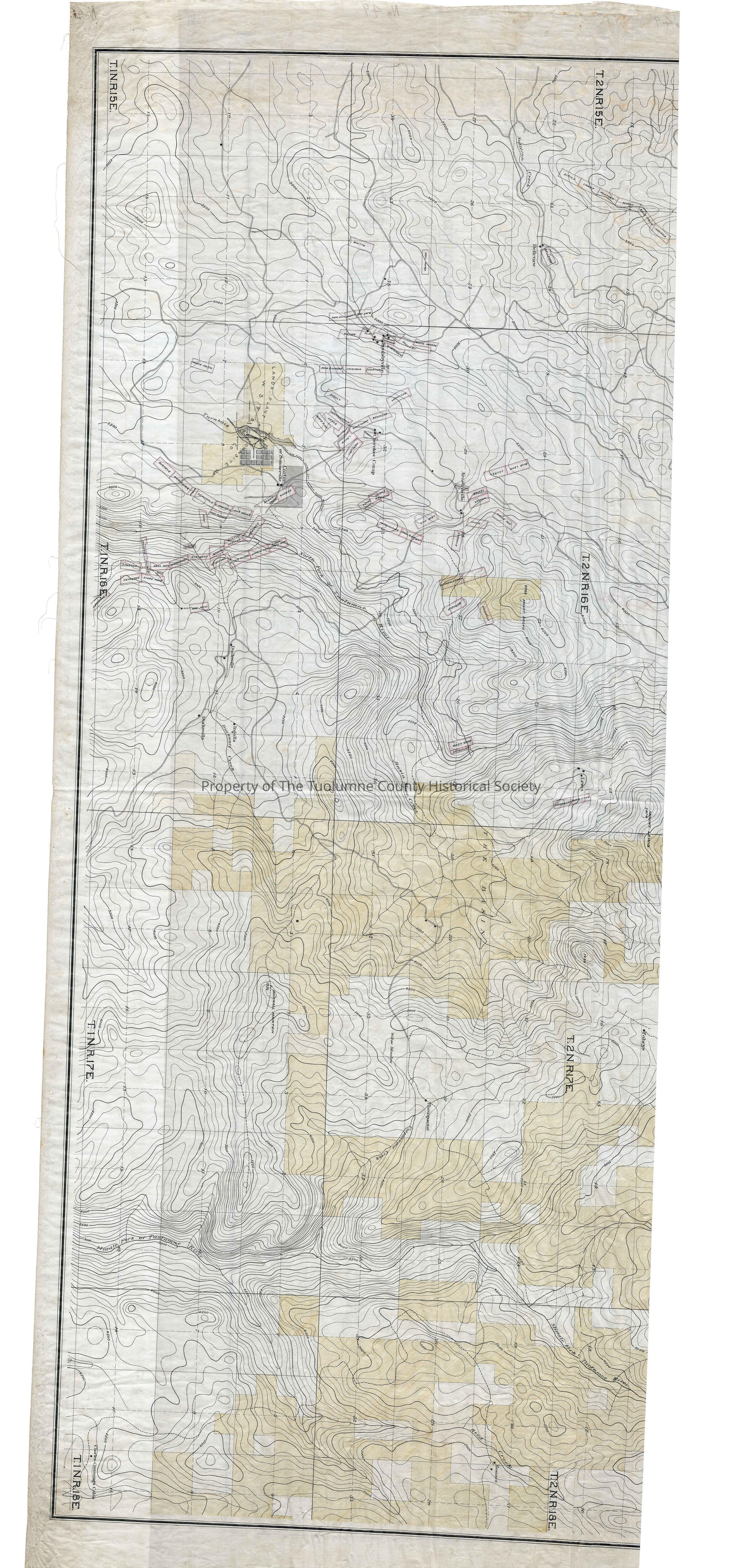
Search Terms
forest map, logging industrty, mining, Sonora Pass Road, Forest road from Long Barn to Rush Creek, Road from Confidence on Sonora pass road to Carters, Road from Arastaville SE aacross the river to Duckwalls and then a split south and north., Sullivan Creek, Turnback Creek, North Fork Of The Tuolumne River, Duckwall Creek, Basin Slope Creek, Cottonwood Creek, Middle Fork of the Tuolumne River, Reed Creek, Wright Creek, Rush Creek, Hull Creek, Two Mile Creek, Mines, Ohio Parole, Lamphier, N Confidence, Confidence, Independence, Sirius, Comet, Fortuna, Minot, Belle Italia, Indiana, Belleview, Well Rough, Whitto, Black Oak, Carrie, Live Oak, Gilson, Platt, Mill, Churchill, Johnson, Bradbury, Independant, Soulsby, Wheal Perran, Park & Neaason, Lousiana, Leviathan, Mastadon, Cherokee, North Star, Charlotta, Laura, Mercury, Radest M, Mammon, Empire, Sunny South, Prudhomme, Park & Bright, Lava Hill, Blue Lead, Laurel, Rising Sun, Mohler, Center, Ophir, Cordova, Uncle Sam, Hidden Treasure, Duffield, Donnello, Extension, Good Hope, Spartan, Sherman, Starr King, Millsite, New Year, Providence, Consuelo, Mary Ann, Bonita, Garfield, Grizzly, Buckeye, Worcester, Georgia, Seminole, Haw, Y America, Mayflower, Lena Belle, Summers, South Ext W, New Albany, New Albany North, Eureka, Dead Horse, Somerset, Monte Cristo, Basin Slope, Homesteads, Duckwalls, Thompsons, Ingalls, Charles Cummings, Rosasco, Lewis, Faheys, Lord, Manns, Harding, Merrills, Carters, Summersville, Arastaville, lands of West Side Flume & Lumber Co.