Name/Title
West Side Lumber Co Tuolumne Calif.Entry/Object ID
M15226Scope and Content
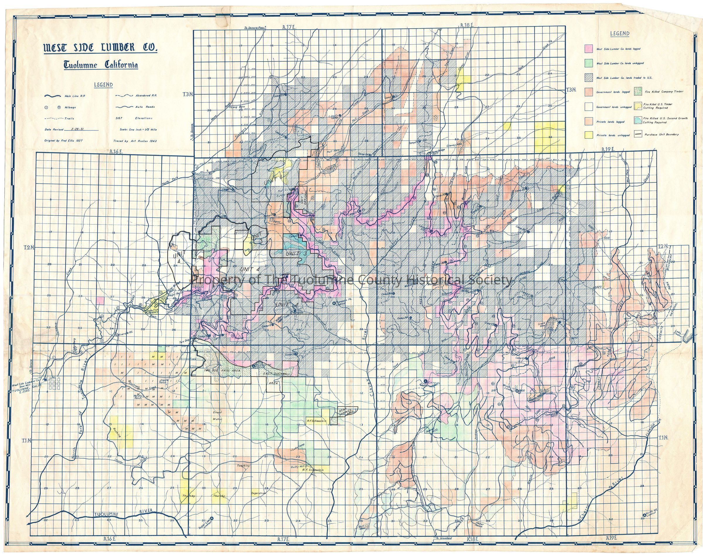
color-coded map with color legend showing ROW and land holdings from Tuolumne to Camp 44; prepared by Art Ronten
Great Information. Map is color coded and shows: West Side lands logged, unlogged and traded to U.S., Government land logged and unlogged, private lands logged and unlogged, fire killed Company timber, fire killed U.S. timber and fire killed U.S. second growth. Map also shows: mainline R.R., mileage, trails, abandond R.R., auto roads and elevations.
Orginal base line map by Fred Ellis 1927
Traced by Art Ronten 1943
Revised 1951 (Art Kauppi description)
This map has been summarized as being a duplicate of the map in file # M15222. It is except for the cut units superimposed on the western portions due to fire activity. (Probably the Wrights Creek fire of 1949). Any researcher should look at the M15222 map file also.
Company lands apparently burned in the Wrights Creek Burn of 1949 can be seen just south of Duckwall Peak and Two Dog Pass. Units 1, 3 & 4 straddle upper Basin Creek and Cottonwood Creek. They all appear to be government lands. I don't see a block 2. (Rutty description)
Scale: 1 inch = 1/2 mile
Township/Range/Section: see file M15222Collection
Standard Lumber Company CollectionLexicon
Search Terms
see M15222, see M15222