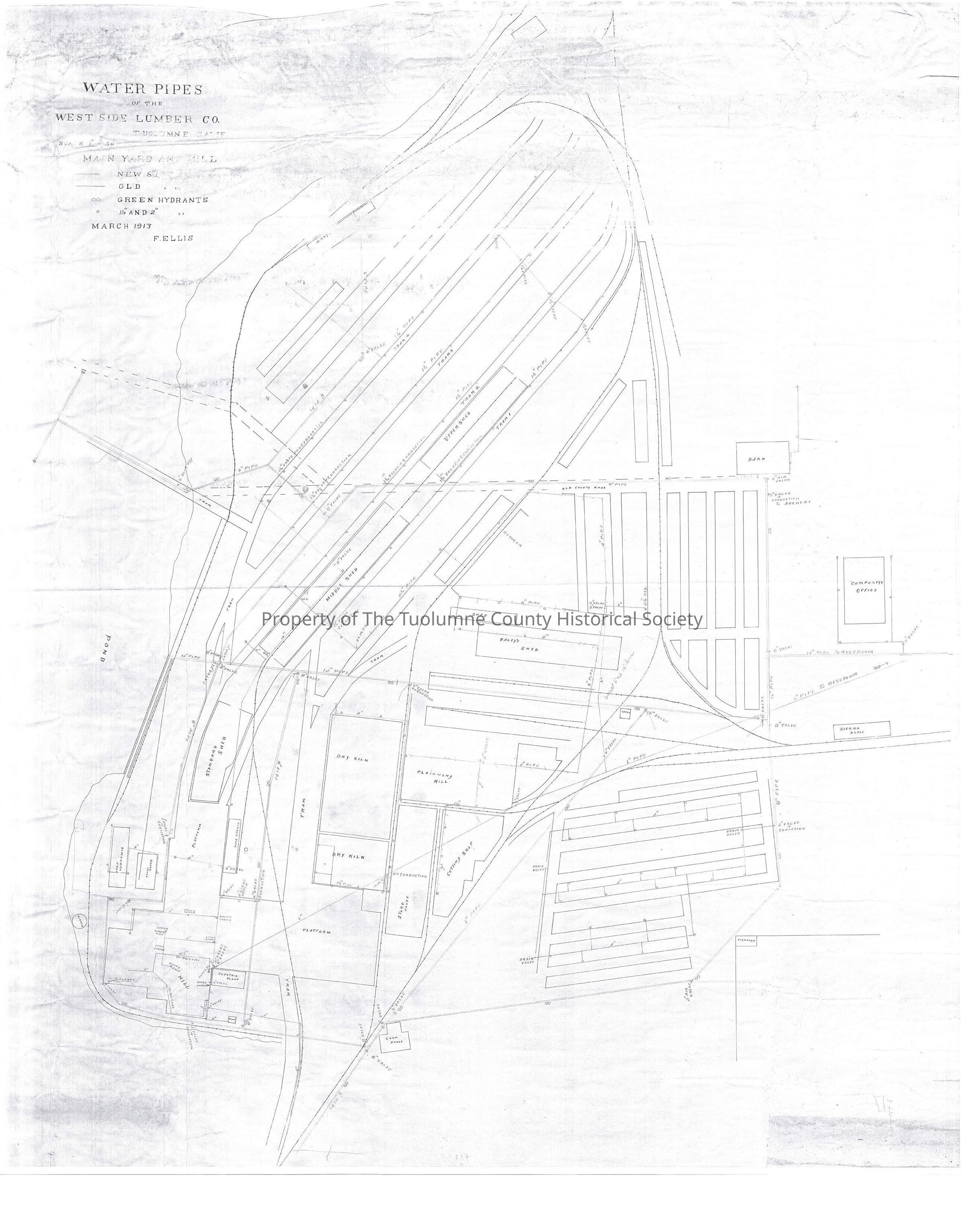
Water Pipes of the West Side Lumber Co. Tuolumne California Main Yard and Mill
Entry/Object ID
M13750
Description
Waterway
Maps showing water pipes in West Side Lumber Co's Tuolumne City Plant. By Fred Ellis
See other map M13752 (Kauppi description)
This is a map or plat of the water system installed primarily for fire fighting purposes. But it also services the boilers and probably all of the usual needs as well. The map is dated 1913 so I would guess the pipes are probably the original installations. This map shows in detail where all the valves and standpipes are installed for easy access if some needed to get to them in a hurry, assuming this was posted where they could see it. It may be partly what the Sanborn maps (see M13755) were used for. They are probably more useable to the general public than one such this.
The system appears to begin to the east at a reservoir there. A six inch pipe runs from there straight to the sawmill and supplies the sawmill as well as the filing shop and adjacent rooftops.
There's also a 16 inch pipe running from the reservoir to the nearest lumber yard. From there it Ts going left and right. Still a 16 inch pipe the left bound pipe goes towards the end of the drying yards. There is a 8 inch straight ahead but where it goes left there is a twelve inch valve. This line goes off this map.
The other pipe has an 8 inch valve almost immediately. It also reduces to 8 inch pipe. It then goes right to the old county road and then goes left. It pretty much circles the property feeding out lines where needed. The map shows where there are drain valves, air valves and blow offs. (Rutty description)
Township/Range/Section: T1N R16E section 8
Collection
Standard Lumber Company Collection
Lexicon
Search Terms
Maps, fire protection, water distribution, Water Pipes of the West Side Lumber Co., Turnback Creek, Barn, 4 Drying Sheds, 2 Offices, Railroad depot, 2 kilns, blacksmith shop