Name/Title
Logging 1935 Season--West Side Lumber Co.Entry/Object ID
M13747Scope and Content
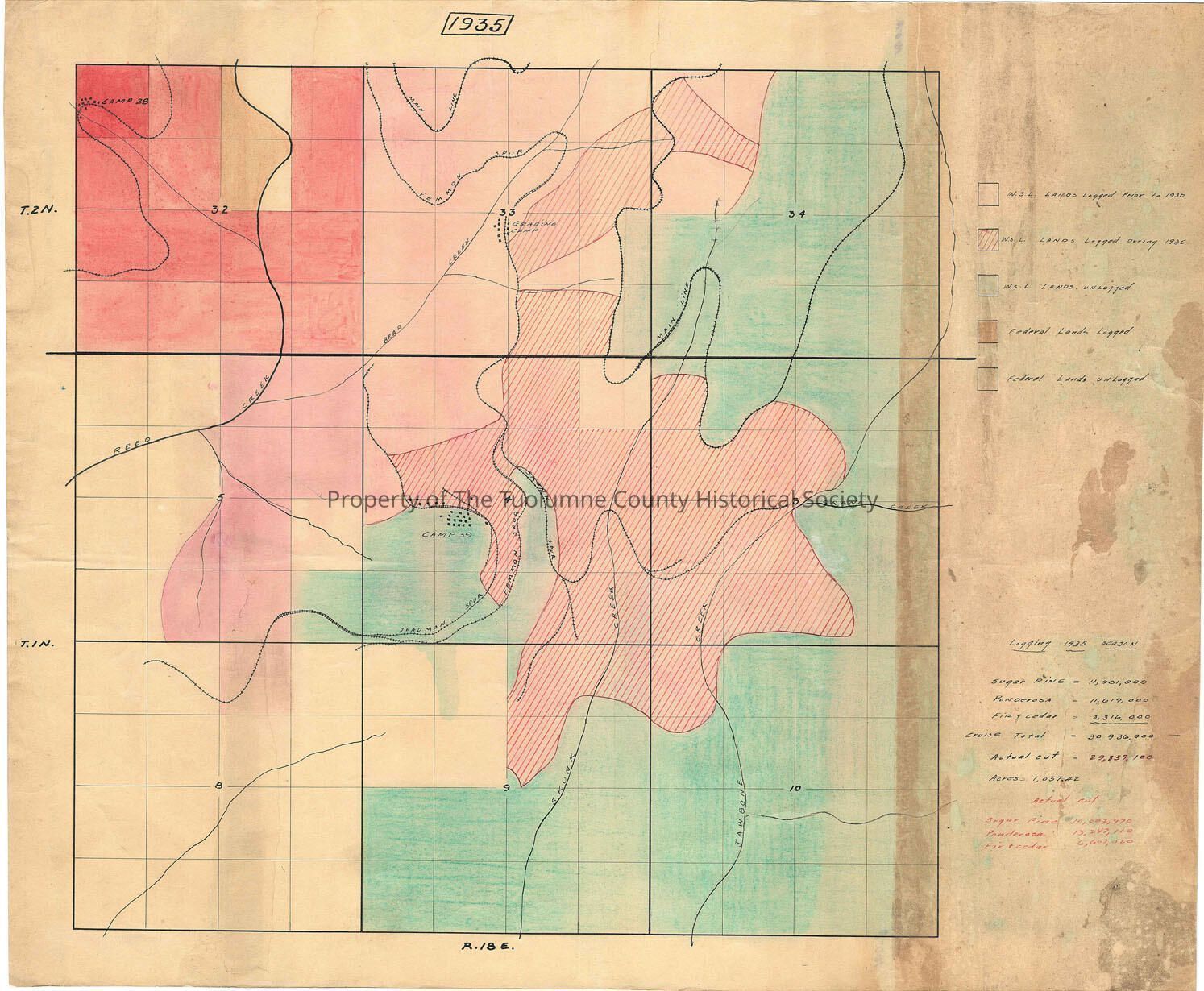
Color-coded map showing land classifications for logged areas during the l935 logging season for West Side Lumber Co.
It also shows lands in the area owned by the US government (Stanislaus NF) some of which are logged and some are unlogged. It also shows quite a bit of West Side Lumber Co. lands which are unlogged.
Area includes 9 sections north of R.18E (32-34; 3-5; 8-10); shows location of camps 28 (NW corner of the map) and 39 (on Deadman Spur), along with a grading camp in section 33 near Bear Creek.
The legend is interesting in that it shows the amounts of timber cut by species. The total actual cut was 29,857,100 bd.ft.
Scale: unknown
Township/Range/Section: T2N R18E Secs. 32, 33, 34 T1N R18E Secs 3,4,5, 6,9,10Collection
Standard Lumber Company CollectionLexicon
Search Terms
forestry map, logging industry, West Side Lumber Co., West Side Lumber Co. Railroad, Reed Creek, Bear Creek, Skunk Creek, Jawbone Creek, Grading Camp, Camp 28, Camp 39, West Side Lumber Co. 1935 timber cut.