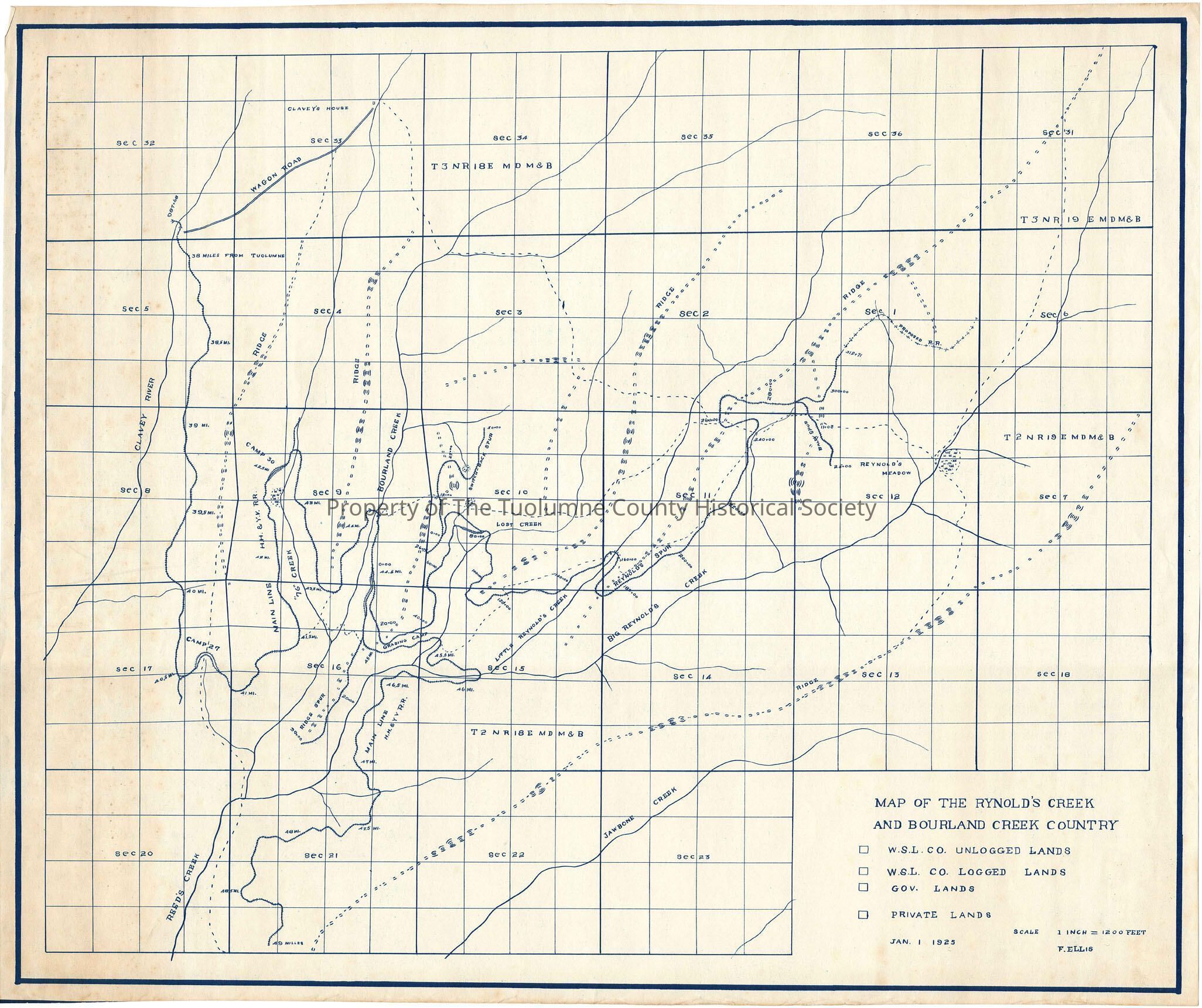
Reynolds Creek and Bourland Creek Country (Note misspelling of Reynolds)

Name/Title

Reynolds Creek and Bourland Creek Country (Note misspelling of Reynolds)

Entry/Object ID

M13745

Scope and Content

A map of the Bourland/Reynolds creek area. showing railroad right-of-way and camp locations; this map is not color-coded but the legend suggests it is a copy of an original that was color-coded (which apparently showed which sections were logged, unlogged and which lands belonged to federal govt. The map depicts a wagon road to Clavey's house in section 33 in T3N R18E. The railroad enters the map at mile post 38 from Tuolumne. The map shows mainline (Hetch Hetchy & Yosemite Valleys Railroad) constructed to mile post 49 in the Reed's Creek drainage. The Ridge spur is about a 1/2 mile long while the Reynolds spur winds through the Little Reynolds drainage and then quite some distance through Reynolds Creek. Camp 27 is on the mainline at a siding in a side drainage of Reeds Creek. Camp 30 was near a siding on the mainline in Looney Creek. The Grading Camp is located on a ridge above Reynolds Creek, just below the junction of Reynolds Creek with Lost Creek. Scale: 1 inch = 1200 feet

Collection

Standard Lumber Company Collection

Lexicon

Search Terms

forest map, logging industry, logging railroad, Clavey Wagon road, Hetch Hetchy & Yosemite Valleys Railroad, Clavey River, Reeds Creek, 76 Creek, Bourland Creek, Little Reynolds Creek, Reynolds Creek, Lost Creek, West Side Lumber Co., Camp 27, Camp 30, Grading Camp, Map of Bourland Creek and Reynolds Creek Coountry