Holdings of Pickering Lumber Co. between Reeds Creek and Cherry River

Name/Title

Holdings of Pickering Lumber Co. between Reeds Creek and Cherry River

Entry/Object ID

M13740

Scope and Content

Map of The Holdings Of The W R Pickering Lumber Company Of The District Between Reed's Creek And Cherry River, Showing Principally The Railroad, Railroad Surveys and Proposed Railroads. The above is the full title of this map. It was drawn by Fred Ellis, and is dated Jan. 1 1926. I believe this to be a map for the use of the top staff personnel for understanding the recently acquired West Side Lumber Company of Tuolumne Lands. This map displays the entire West Side Lumber Company landed assets as of 1926. The legend is set to have colors denoting land ownership and whether it was logged. This map hasn't been color coded. Note the Railroad mainline is labeled "Hetch Hetchy & Yosemite Valleys Railroad". The mailine is depicted from mile post 41 (41 miles from the sawmilll at Tuolumne), to milepost 46. From there, there is proposed trackage to mile post 61 and beyond. To as far as Cherry Creek. I think other maps put it at mile post 75. Numerous spurs are planned to tap the timber in each drainage. Scale: 1 inch = 2000 feet Location: Tuolumne County, Reeds Creek to Cherry Creek Township/Range/Section: T3N R18E, T2N R17E T2N R18E, T2N R19E, T1N R17E T2N R18E T1N R19E

Collection

Standard Lumber Company Collection

Lexicon

Search Terms

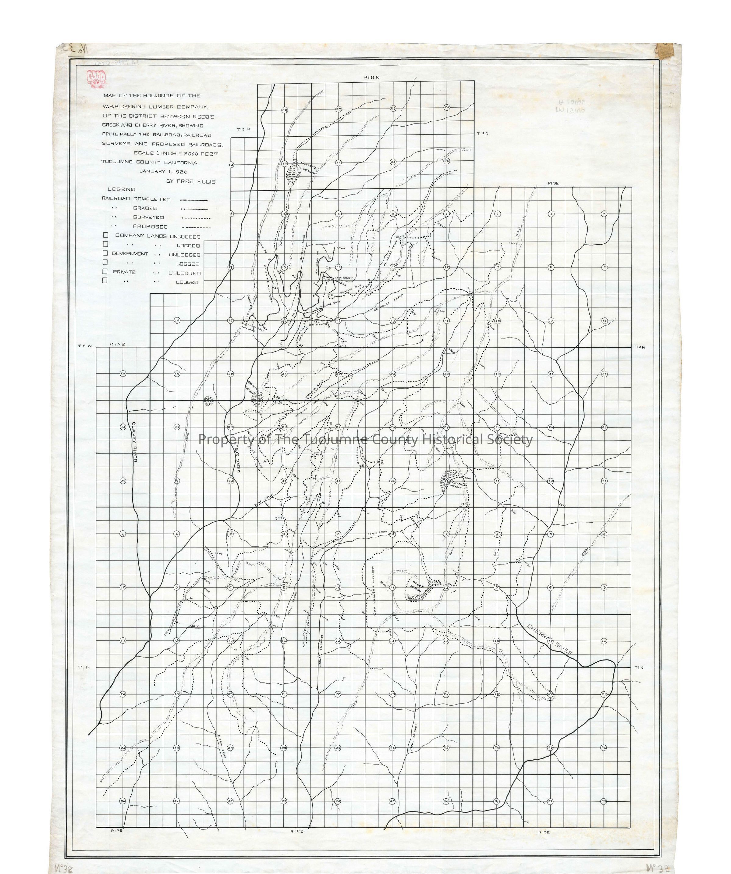
forestry map, logging, railroading, Hetch Hetchy & Yosemite Valleys Railroad, W R Pickering Lumber Company, Tuolumne, Clavey River, Reeds Creek, Crane Creek, Bourland Creek, Lost Creek, Little Reynolds Creek, Reynolds Creek, Niagara Creek, Bear Creek, Jawbone Creek, Skunk Creek, Granite Creek, Cherry River, Woods Meadow, Crane Meadow, W R Pickering lands Reeds Creek to Cherry River