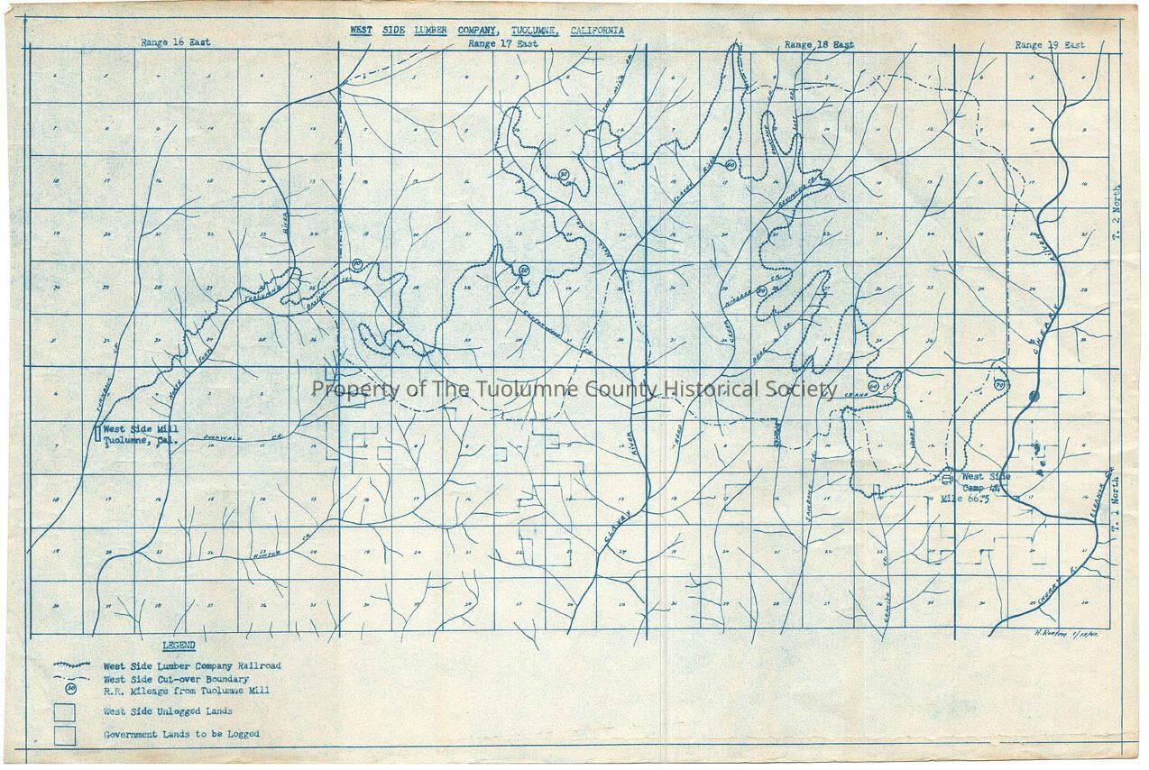
West Side Lumber Company, Tuolumne, California

Name/Title

West Side Lumber Company, Tuolumne, California

Entry/Object ID

M13706

Scope and Content

general, non-detailed map showing ROW from Tuolumne City to Camp 44 (Kauppi description) A non detailed map, showing only the railroad and the drainages and a West Side cutover boundry. The only logging camp shown is the one near the end of the railroad, Camp 44 at Mile Post 66.5. The end of tracks is just past MP 70 in the Cherry River drainage. MP 10 is in Basain Creek. MP is in Cottonwood Creek. MP 30 is found in Hull Creek. The Clavey River is home for MP 40. MP is in Niagara Creek. MP 60 is in Crane Creek (Rutty description) Location: Tuolumne County - N Fk Tuolumne River to Cherry River Township/Range/Section: T2N R16E, T2N R17E, T2N R18E T2N R19E, T1N R16E, T1N R17E, T1N R18E,

Collection

Standard Lumber Company Collection

Lexicon

Search Terms

forest map, logging map, railroad map, N Fk Tuolumne River, Basin Creek, Cottonwood Creek, Hull Creek, Two Mile Creek, Clavey River, Bourland Creek, Lost Creek, Reynolds Creek, Niagara Creek, Bear Creek, Crane Creek, Duckwall Creek, Cherry Creek, Woods Creek, Granite Creek, Jawbone Creek, Reed Creek, Skunk Creek, Hunter Creek, West Side Lumber Co. main line display