Represents ROW mile post 10 through 34 (not detailed) prepared by Art Ronten (Kauppi description)
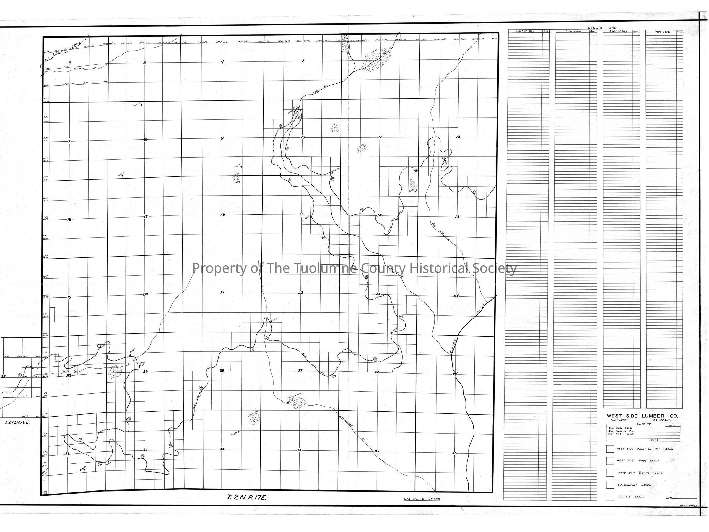
This is map 1 of 3 of a series of three maps. This one has all of the trackage on one map. Map 2 of the series displayed one township on a map and Map 3 dealt with the remaining outlying pieces. As with map 2 the 1/16 sections the tracks ran through
and the Company was planning to trade with the government in 1940 were further subdivided into 1/64th sections. (1/10 acre.)
Camp 8 is in the NW 1/4 of section 29, T3N R17E, adjacent to the tracks. (This is Nashton). Camp 9 is just past mile post 15 in section 32. Camp 16 is just past Cottonwood Creek at about MP 19 1/2. Camp 21 is well up the slope but is in the Clavey Roiver drainage. Its located in the SE 1/4 of section 23, T1N R17E on Quilty Creek. Camp 23 is in section 15 just SE of center. The township is T2N R17E. Camp Hull Creek is at Hull Meadows in section 10 T2N R17E. Camp 24 is in section 10 at the very SE corner. Camp 25 is at MP 33 in section 12 SW corner, T2N R17E. (Rutty description)
Location: Tuolumne County - Basin Creek to Clavey River
Township/Range/Section: T2N R17E
Collection
Standard Lumber Company Collection
Lexicon
Search Terms
forest map, logging map, railroad maagement map, N Fk Tuolumne River, Wrights Creek, Lilly Creek, Hull Creek, Two Mile Creek, Clavey River, Cottonwood Creek, West Side Lumber Co Railroad, railroad right of way lands