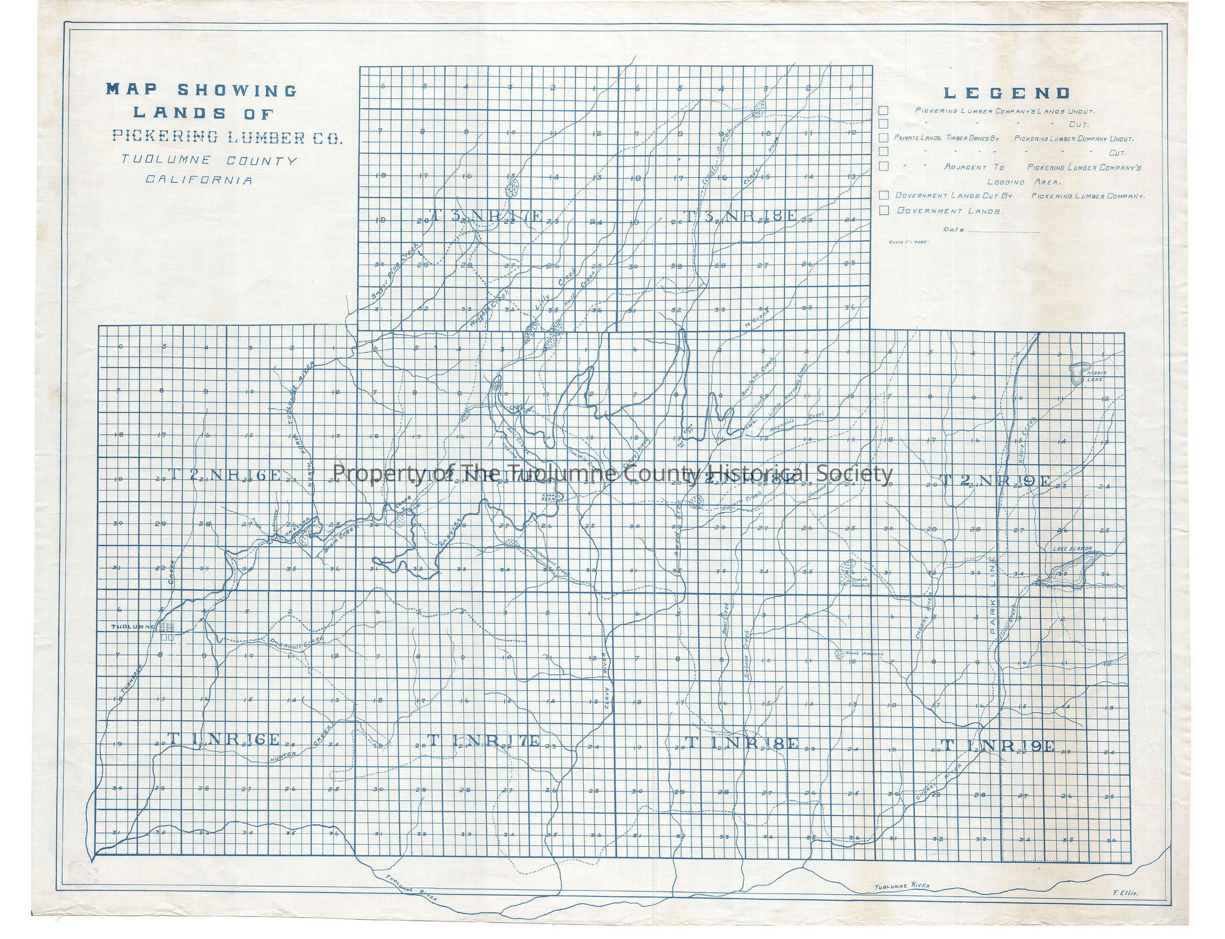
Lands of Pickering Lumber Co

Name/Title

Lands of Pickering Lumber Co

Entry/Object ID

M13716

Scope and Content

Prepared by Fred Ellis; shows ROW from Tuolumne to Bourland Creek (Kauppi description) A previous map shows the railroad located to Reed Creek in late 1919. This map shows the railroad only about 2 miles along since that date which would indicate that this map dates from 1920. This map does not display spurs and trestles or grades. It does show the camps and mileage points. Camp 8 (Nashton) is located at milepost 11. Three trails depart from there goes down Cottonwood Creek to Lake Eleanor, One goes to one of the tributaries of the N Fk of the Tuolumne River about three miles North, and the third ties into another trail going into the park to the north. Camp 21 is at mile post 22.5. Camp 24 is at mile post 29. Camp 27 is located at mile post 40.5 between the Clavey River and Reed Creek. They show end of track at Lost Creek in the upper NW corner of section 15 T2N R18E Scale: 1 inch = 4000 feet Township/Range/Section: T3N R17E T3N R18E T2N R16E T2N R18E T2N R19E T1N R16E T1N R17E

Collection

Standard Lumber Company Collection

Lexicon

Search Terms

forest map, logging map, railroad map, North Fork of the Tuolumne River, Trout Creek, Clavey River, Hull Creek, Lilly Creek, Wrights Creek, Sugar Pine Creek, Two Mile Creek, Bourland Creek, Lost Creek, Litttle Reynolds Creek, Reynolds Creek, Jawbone Creek, Niagara Creek, Reed Creek, Cottonwood Creek, Basin Creek, Camp 8 (Nashton), Camp 21, Camp 24, Camp 27, Lands of Pickering Lumber Company