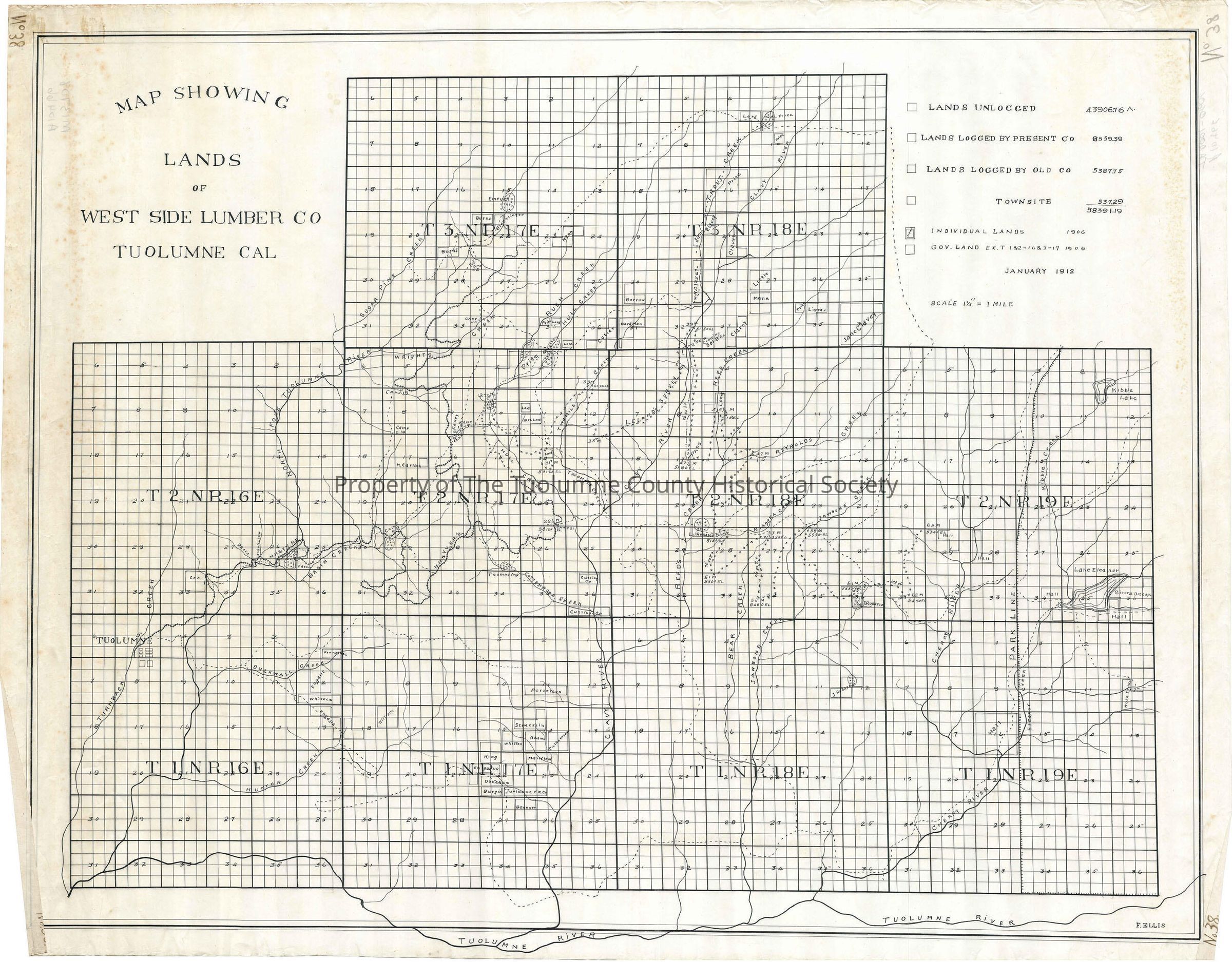
Lands of West Side Lumber Co Tuolumne Cal

Name/Title

Lands of West Side Lumber Co Tuolumne Cal

Entry/Object ID

M13708

Scope and Content

Prepared by Fred Ellis (Kauppi description) The railroad departs Tuolumne and goes to the first junction shown on this map the NE corner of section 28 of T2N R17E. Prior map showed a substantial spur south of this one as well as several short ones up side canyons to tap timber in those areas. So more landscape has been cutover than what the railroad as shown here would have you think. From the NE corner of section 28 that branch winds its way about three miles into the Hull Creek drainage. The main line continues north past its last stopping point at Fahey meadow to the North Fork of the Tuolumne River opposite Merrill Springs. Camp 8 (Nashton) is shown as being near Basin Creek on a tributary. Camp 21 is at mile post 22.5 in the NE 1/4 of section 26. Camp 17 is in the SE 1/4 of section 9T2N R17E. Camp 20 is on Wrights Creek, while Camp 22 is planned to be on a rail spur, in the NE corner of section 28 T3N R17E. Scale: 1 1/3 inch = 1 mile Location: Tuolumne County - Wrights Creek Township/Range/Section: T3N R17E T3N R18E T2N R16E T2N R17E T2N R18E T2N R19E

Collection

Standard Lumber Company Collection

Lexicon

Search Terms

forest map, logging industry, railway right of way, Tuolumne, Trout Creek, Clavey River, Rush Creek, Hull Creek, Wrights Creek, Sugar Pine Creek, North Fork of the Tuolumne River, Two Mile Creek, Reed Creek, Reynolds Creek, Jawbone Creek, Kibble Creek, Niagara Creek, Turnback Creek, Duckwall Creek, Cottonwood Creek, Bear Creek, Hunter Creek, Camps 8, Camp 17, Camp 19, Camp 20, Camp 21, Camp 22, Hetch Hetchy & Yosemite Valleys Railway, West Side Lumber Co timber lands