Name/Title
Railroad From Camp 21 to Clavey RiverEntry/Object ID
M13710Scope and Content
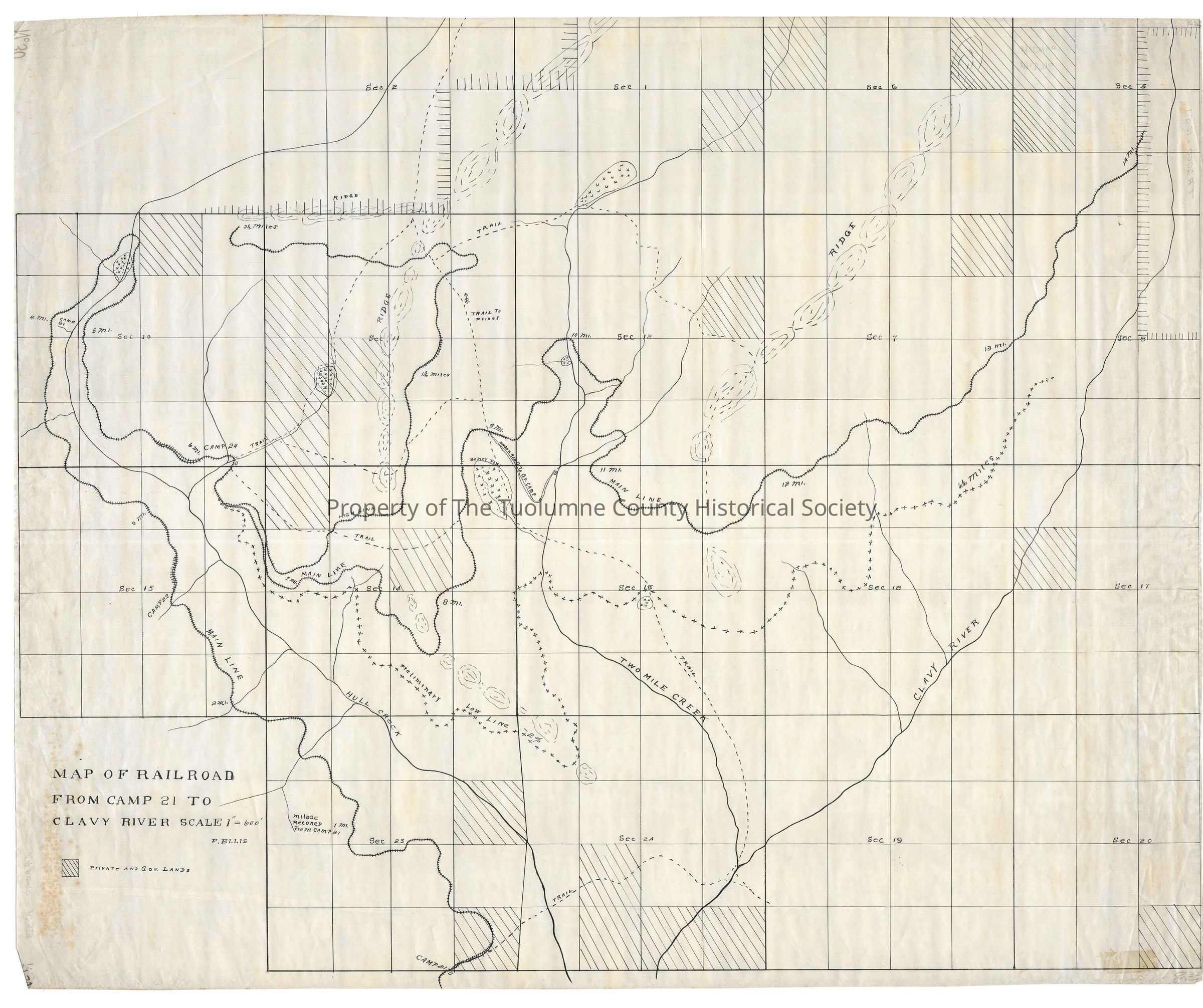
Fairly detailed map by Fred Ellis of area cited (Kauppi description)
This map doesn't have a base foundation such as contour lines and the typical place names, roads and trails to found of this area. There is a sectional grid but no township and range information. From work on the other maps I'm certain we're in Township 2N and Ranges 17E and 18E.
The trackage starts at Camp 21 near lower Hull Creek. About 2 1/2 miles puts us at Camp 23. From there we continue up Hull Creek passing Camp Gr(?) at 4 miles. At about 4.5 miles the tracks cross Hull creek above Funk's Meadow to the east side of Hull Creek. From there it proceedes SE to Camp 24 in the SE corner of section 10 T2N R17E. Another half mile and the tracks split. The High line Heads north while the Mainline heads east then north. The High Line heads north to the top of section 11 where it turns west for a length of 3.5 miles
The mainline continues into section 14 T17E R17E It passes north of Boney Flat and at the 9 mine point encounters a wagon road. The tracks wind further north and at the ten mile mark from Camp 21 it crosses Two Mile Creek, going SE it winds thru two significant tributaries of Two Mile Creek. The map is pretty featureless but the tracks progress NE reaching the Clavey River at about 13 miles and coming close to the river itself at 14 miles in section 5 T2N R18E (Rutty description)
Scale: 1 inch = 600 feet
Location: Tuolumne County - Hull Creek to Clavey River
Township/Range/Section: T2N R17E secs. 1,2, 10, 11, 12, 13, 14, 13, 15, 23, 24 T2N R 18E secs.Collection
Standard Lumber Company CollectionLexicon
Search Terms
forest map, logging map, railroad map, Camp 21, Clavey River, wagon road to Gr. camp, trail to Price's, Hull Creek, Two Mile Creek, Camp 23, Camp Gr, Camp 24, Boney Flat, Map of Railroad from Camp 21 to Clavey River