West Side Lumber Company Block Map Tuolumne Tract Tuolumne County California

Name/Title

West Side Lumber Company Block Map Tuolumne Tract Tuolumne County California

Entry/Object ID

M13712

Scope and Content

Vicinity of T2NR16E throughT2NR19E, and T1NR16E through T1NR19E (kauppi description) This map shows the Sierra Railroad going into the town of Tuolumne and then the Hetch Hetchy and Yosemite Valleys Railroad proceeding into the forest as far as Reeds Creek. This is not a contour map but it does show streams in good detail as well as mountain tops. The railroad is shown with the mainline only, no spurs, and no details such as camps, mileage, grades etc. as found on other maps. The constructed track is shown to Reed Creek and proposed trackage is shown to Cherry Creek. (Rutty description) Scale: 1 inch = 1 mile Location: Tuolumne County County - Tuolumne to Cherry Creek Township/Range/Section: T3N R17E T3N R18E T2N R16E T2N R17E T2N R18E T2N R19E

Collection

Standard Lumber Company Collection

Lexicon

Search Terms

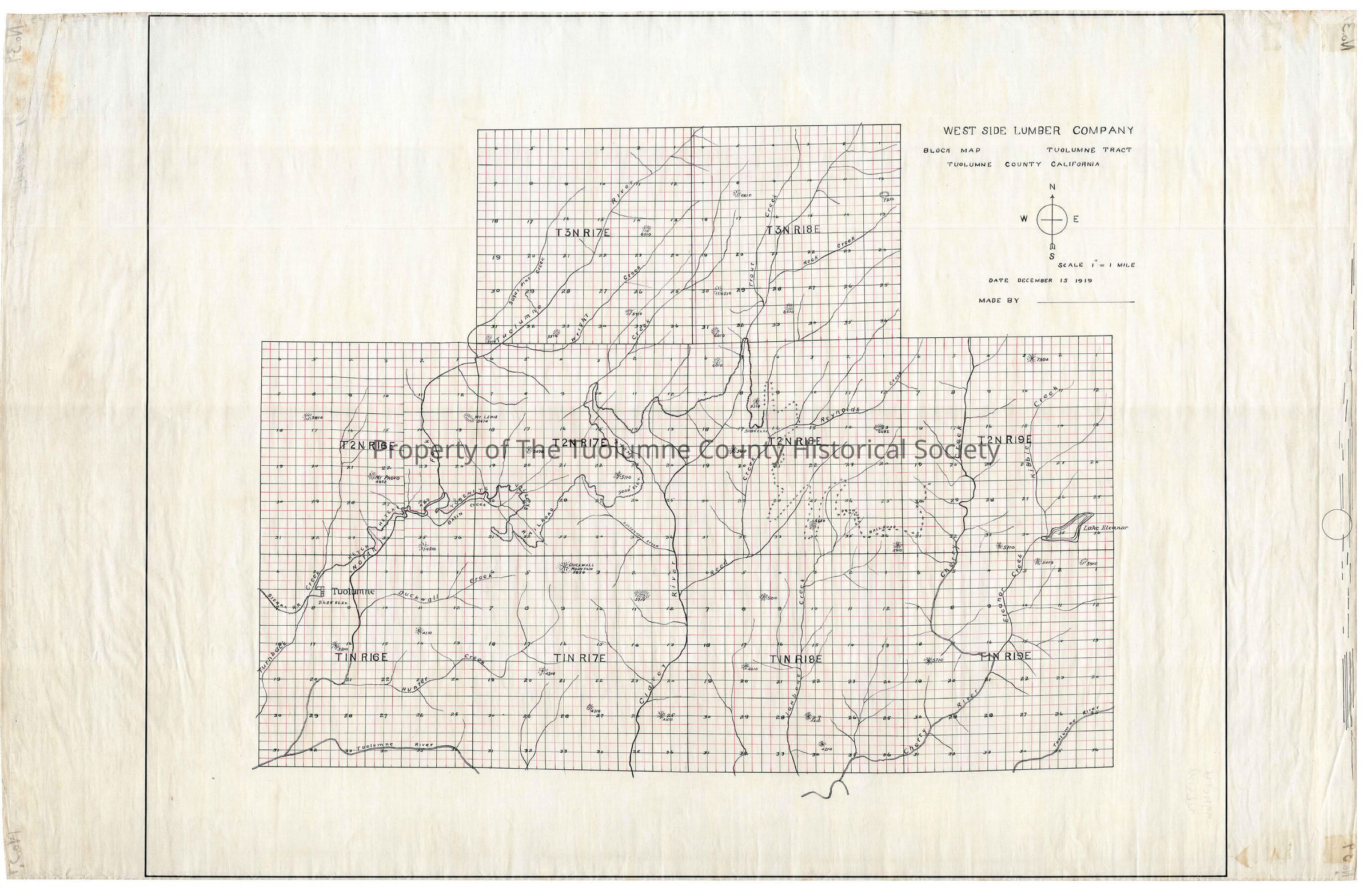
forest map, logging map, railroad map, Sugar pine Creek, North Fork of the Tuolumne River, Wright Creek, Hull Creek, Reynolds Creek, Cherry Creek, Clavey River, Cottonwood Creek, Reed Creek, Turnback, Duckwall Creek, Hunter Creek, Jawbone Creek, West Side Lumber Company Block Map Tuolumne Tract