Lands of West Side Lumber Company Tuolumne County California

Name/Title

Lands of West Side Lumber Company Tuolumne County California

Entry/Object ID

M15032

Scope and Content

Pastel color-coded; shows ROW Tuolumne to Camp 13, WSLCo; shows land holdings as far east as Crane Meadow (Kauppi description) This map is brown and black ink on a light gray drafting vellum. Much easier to work with than the previous few maps. The map coverage is from Tuolumne to Lake Eleanor in Yosemite Park. (Probably because of the company interest in providing passenger service to the Park at some point). The tracks are now plotted to section 3 on the NE shoulder of Duckwall Mountain. Camp 13 has been established about a mile back on a tributary of Cottonwood Creek. A wagon road has been built from Tuolumne to Buchanan Mine and North to Faheys Meadow and beyond. Scale: 2 inch = 1 mile Township/Range/Section: T3N R17E, T3N R18E, T2N R16E, T2N R17E, T2N R18E, T2N R19E

Collection

Standard Lumber Company Collection

Lexicon

Search Terms

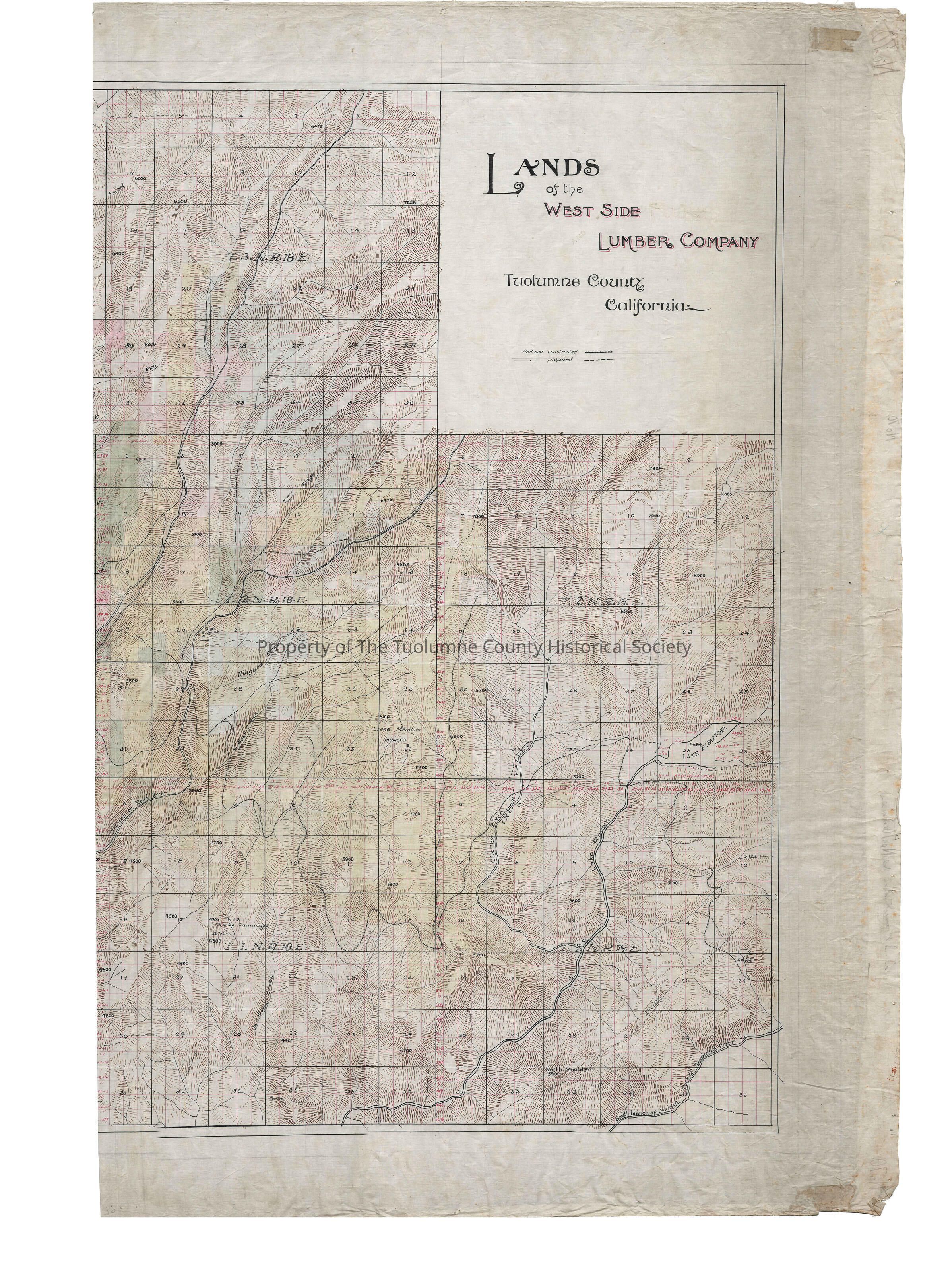
forestry map, logging industry, mining industry, Turnback Creek, North Fiork Tuolumne River, Hunter Canon, Duckwall Creek, Basin Creek, Clavey River, Wrights Creek, Hull Creek, Two Mile Creek, Niagara Creek, Bear Creek, Reed River, Cherry River, Jawbone Creek, Camp 13, Stiles House, Duck Walls, Ingalls, L. Duck Walls, Thompsons, Rhoades, Nashton, Faheys, Manns, Hardins, Lord's House, Charles Cummings, Rosasco, Lands of West Side Lumber Co.